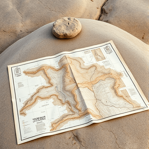
When you think about desert hike water, your first instinct is to calculate how much you can carry. The more advanced skill—and the one that separates a prepared hiker from a stranded one—is the ability to read the terrain to find hidden springs before you even drop your pack. A topographic map, read with an eye for hydrology, turns a barren wash into a sequence of clues that point to water moving beneath the sand. This year, with better elevation data and free satellite tools, that skill is easier to develop than ever.
The Hydrological Grammar of a Topographic Map
Topo maps are not just contour lines; they are a schematic of how rainwater will behave on the earth’s surface. Every line of elevation change tells you where water gathers, where it disappears, and where it is forced back to the surface.
Contours, Dry Washes, and the Shape of Hidden Flow
Look for the classic V-shaped contour signatures that point uphill. Those are drainages. A dry wash on a map is a dotted or dashed line at the bottom of the V, but the real question is whether that wash holds shallow groundwater. The answer appears where the contour lines change character quickly. Find a spot where the gradient flattens abruptly inside a narrow canyon. That transition is where flowing sediment drops, water slows, and moisture can be stored beneath the gravel. Conversely, steep, tightly packed contours mean fast runoff, which is less reliable in summer but dangerous after thunderstorms.
Springs and the Anatomy of Fault Lines
Springs rarely appear out of nowhere. They emerge where an impermeable layer of rock tilts upward and forces groundwater sideways, or where a fault creates a crack that lets water escape to the surface. On a topo map, look for offset drainages, an unusually straight canyon segment, or a row of small depressions—these are classic signs of a fault trace. When you see one crossing a drainage, you have just found a place where water might be forced upward. Hikers often call these “hidden springs” because the surface shows only damp sand.
- Tightly packed contours at the mouth of a side canyon can indicate a bedrock step that traps water.
- A dashed spring symbol on an older USGS map is more reliable than you think—check it in February.
- Contour lines that bend sharply around a convex hillside may mark a buried seep line.
Use Digital Terrain Layers to Think Like a Hydrologist
In 2026, you no longer have to rely on paper alone. High-resolution elevation data and satellite imagery are free through government portals and can reveal terrain signatures that older maps miss.
LiDAR and the New Topographic Detail
LiDAR-derived elevation models, available through the U.S. Geological Survey’s 3D Elevation Program and open platforms like OpenTopography, expose micro-basins that a 40-foot contour interval hides. Load a hillshade layer and set the transparency to 50 percent over a standard topo map. Suddenly, the ancient channels of former washes appear as faint lines on alluvial fans. These abandoned channels are excellent spots to dig for water after recent rain, and they are invisible on the printed map.
Vegetation and Thermal Satellite Data as Water Proxies
Open a satellite scene from the past 10 days and look for a strip of greener vegetation in the middle of a desert canyon. Sentinel-2 imagery includes an NDVI index that can be calculated with free tools like Sentinel Hub. A persistently green pixel in a dry drainage is a strong sign of a shallow groundwater source. Thermal infrared data, available from Landsat, can also highlight cooler patches of soil that suggest evaporation. Use these sights as screening tools, then confirm with a topo map and your own feet.
Water Field Signatures in a Dry Wash
The terrain reading does not end at the map. When you are standing in a dry wash, you need to translate the contours into physical water signatures.
The Inside Bend vs. the Outside Bend
The deepest water flows against the outside curve of a bend, scouring down to bedrock or coarse gravel. If any moisture is present, it collects there, beneath driftwood and tangled roots. The inside bend, where sand accumulates, is drier. So when you walk a channel, do not follow the center; walk the outside edge of every bend and look for damp spots where the soil changes color. A patch of lighter, oxidized sand next to gray gravel is often a sign of recent moisture.
Animal Trails and the Green Cluster Indicator
Desert bighorn sheep and burros are excellent terrain readers. If you see a network of narrow trails converging from the hillsides into one point in the wash, there is probably water there. Above the ground, look for willows, desert fan palms, or a single cottonwood tree. They do not survive on random flash floods alone; their roots are tapping a reliable subsurface source, so a lone tree in a wide wash is one of the best signs you can find.
Rock Catchments and the Art of the Tinaja
Rock catchments are a different kind of desert water source: water that sits on the surface after a storm, stored in natural bowls of solid granite. Topo maps, especially in the Southwest, sometimes mark these as “tinajas” or “soap holes.” But many tinajas are unlabeled because they hold water for only weeks at a time. You must learn to read the rock itself.
Plunge Pools and the Shape of the Contour Bowl
On a stiff granite dome, rainwater follows fracture lines into shallow depressions. On a topo map, a tinaja appears as a small, closed contour oval with no outlet—a basin perched on the side of the dome, not in a drainage. Look for a series of cascading basins where the contours make two adjacent bowls connected by a narrow spillway. The higher bowl may drain into the lower one, and the lower one is the most likely to hold water because it collects runoff from a larger surface.
Desert Varnish as a Runoff Fingerprint
Desert varnish, the dark brown-black coating on rock faces, takes centuries to form and is the archaeological record of where water flows. When you see a glossy black streak extending from the top of a dome down to a shallow bowl, follow that streak upward. It marks the exact runoff pathway. Hiking up the dark ribbon will lead to the best catchment zone—a wide, slightly concave rock surface that funnels rain into a natural tank. Combined with a topo map, a varnish line is an incredibly reliable indicator of where the rock has channeled water repeatedly over time.
A Four-Step Terrain Reading Workflow for Your Next Desert Hike
Use the following routine before you leave the trailhead. It takes ten minutes and can fully transform your day’s carrying strategy.
- Pull a 24K topo map and circle every known water symbol within two miles of your planned route.
- Identify potential fault-controlled springs by tracing straight lineaments across contour lines.
- Use LiDAR hillshade or high-resolution satellite imagery to find abandoned wash channels and undrained bedrock basins.
- In the field, verify each location before you need a drink, and note where water actually appears in different seasons.
Keep a small notebook with GPS coordinates and your own observations. These notes are gold for future trips. A spring that fails one summer might appear the next, and the timing depends on both the previous winter’s snowfall and the exact route of the storm cells, which you can track year over year.
Ground Truthing: The Map Is Only the First Draft
Terrain reading on a topo map is an act of probability, not certainty. The difference between a hidden spring and a dry hole is often a matter of inches, and the map cannot tell you whether a recent wildfire, drought, or flood has changed the water table. That is why your desert hike water plan should always have redundancy: a known source, a likely source, and a reserve in your pack. Read the terrain, dig the deepest part of the wash, and treat every discovery as a gift. Then filter, treat, and move on with more knowledge than the map alone ever gave you.
In the end, reading the terrain to find hidden springs is not a parlor trick. It is a habit of thinking that connects lines on paper to the living texture of the landscape. The more you practice, the more often that faint dip in the contour line turns out to be exactly where a small pool of cool, clear water waits under the shade of a granite outcrop.