The trailhead looks perfect—blue sky, cooled soil, and a distant ridge that seems to be calling your name. But the question every hiker must answer before stepping foot on singed terrain is simple: is it safe to hike post-fire? The short answer is that safety depends far less on how the fire looked from your car window and far more on how well you read the landscape’s remaining threats. In recent years, agencies have refined how they communicate danger, and knowing how to use burn maps and official alerts is now the single most practical skill for anyone heading into recently burned wilderness.
What Burn Maps Actually Tell You—and What They Don’t
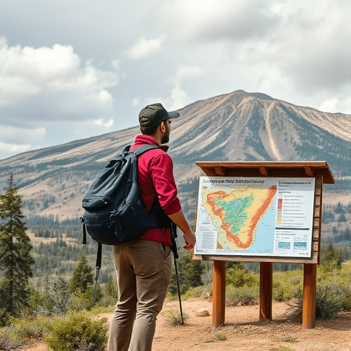
Burn maps, or burn severity maps, are one of the most powerful tools hikers have, yet they are often misunderstood. A basic perimeter map shows only where a fire traveled. A severity map, typically color-coded from green (unburned) to red (high severity), reveals the intensity of the burn in any given patch of land. That distinction matters enormously for trail safety.
High-severity burn zones often mean complete canopy loss, which changes how rain behaves on slopes and increases the likelihood of falling debris. Moderate-severity areas may show partial vegetation recovery but still have unstable root systems. Low-severity burn areas are frequently the safest, but even they can hide smoldering pockets of organic material deep underground. Burn maps give you a starting point, not a guarantee—so use them to identify which sections of a trail to approach with extra caution, not which sections to assume are fine.
The Hidden Hazards That Linger After the Smoke Clears
Most hikers worry about the obvious dangers: falling trees, unstable rocks, or the risk of a flare-up. But the real danger in a burn scar is often invisible. Post-fire landscapes are dynamic, and the most serious threats don’t appear until weeks or months after the fire is contained. These hidden hazards are why official alerts are not optional reading.
Flash Floods and Debris Flows
The most lethal post-fire risk is water. When fire removes vegetation and bakes the soil into a water-repellent layer, even moderate rainfall can trigger flash floods that carry boulders, logs, and mud. Burn maps showing high severity on steep slopes above narrow canyons are an immediate warning sign. If any rain is forecast—even a passing thunderstorm miles away—do not hike into canyon bottoms or narrow drainages.
Root Fires and Falling Trees
Fire can burn underground along root systems for months after the flames above are out. These resurgent fires can suddenly weaken large trees, turning a seemingly safe forest into a falling-hazard zone. Burn maps in areas with thick duff or peat-like soil deserve special caution. Trees with charred bases, exposed roots, or cracks in the trunk are structural liabilities. Always look up and ahead, not just at your footing.
Hazard Trees and Unstable Terrain
Fire-weakened trees can fall without warning, and slopes that look solid may be subtly undermined by burned root networks. Switchbacks and cutbanks are particularly risky. The safest path through a burn scar is often the trail itself, so resist shortcuts even more strongly than you normally would.
How to Read Official Alerts Like a Trail Pro
Official alerts are the most reliable safety signal you have, but they come in different forms—and not all of them are equally urgent. Understanding the language of closures and advisories is key to deciding if it is safe to hike post-fire in a particular area.
- Emergency Trail Closure: Absolutely no entry. This is a legal order, often issued during active fire behavior, post-fire flooding, or when hazards are actively being mitigated. Ignoring it puts you and first responders at risk.
- Conditional Closure: Open only under specific conditions, such as dry weather windows, or closed during rainfall events. Read the conditions carefully. A trail that is open at 9 a.m. may be closed at 2 p.m. when thunderstorms roll in.
- Advisory or Warning: The trail remains open, but an official agency has identified known hazards. Treat advisories as a request to exercise heightened awareness and consider turning back if conditions feel wrong.
Agencies increasingly post these alerts on dedicated fire recovery web pages, alongside interactive maps that layer severity data, reforestation activity, and upcoming prescribed burns. Before any hike, check the local forest service page, not just the trail’s main page. Sometimes the critical note—like a recently discovered hazard tree blocking a drainage culvert—is buried in a weekly update.
Mapping the Post-Fire Trail: A Practical Field Strategy
Rather than relying on a single source, combine what burn maps and alerts tell you into a pragmatic field strategy. One approach that works well is to identify the trail’s exposure before you leave the car. Look at the fire perimeter in relation to the trail corridor. Did the trail run directly through the hottest part of the burn, or was it spared? Is there a segment where the trail enters a narrow canyon with steep, denuded slopes? Which sections have southern or western exposure, which tend to dry out faster but also hold less residual moisture?
You should also estimate how much recovery time has passed since the fire was contained. Some post-fire landscapes begin showing grass and shrub regrowth within weeks, but that visual recovery is misleading. Subsurface root bonds take years to rebuild, and the first heavy rain after a long dry spell is often when slopes fail. Burn maps are snapshot images; they don’t tell you how much rain has fallen since the fire. For that, check local rainfall records. If the burn scar has not yet experienced a significant storm, assume the risk is elevated.
A Pre-Hike Checklist for Post-Fire Trails
Building a mental model of post-fire risk is easier if you have a routine. Run through this checklist each time you plan to hike a burn area—it takes less than five minutes and can save you from a preventable emergency.
- Consult the official burn severity map for your intended trail and note any high-severity segments.
- Check for active closure notices, advisories, or flash-flood watches issued for the burn scar in the last 48 hours.
- Review the weather forecast for the full watershed above the trail, not just the trailhead.
- Identify escape routes: ridgelines are generally safer than drainages if you need to move quickly.
- Tell someone your exact route and planned return time, and mention the fire recovery status of the area.
- Carry navigation tools that work offline, since burn areas can have damaged signage or downed trail markers.
The New Normal of Post-Fire Hiking
What makes 2026 different from previous years is not the existence of burn scars—it is how much of the mountain West and other fire-prone regions are now a patchwork of burns at various recovery stages. The old mental shortcut of “wait for the trail to reopen” is becoming less useful, since many trails are technically open but pass through dangerous terrain. Conversely, some trail segments closed for years are now returning with surprising resilience, offering hikers a rare chance to watch recovery unfold. The landscape is neither unambiguously safe nor permanently ruined. It is simply different, and it demands a different kind of attention.
Burn maps and official alerts are not bureaucratic paperwork; they are the collective knowledge of fire ecologists, hydrologists, and trail managers who understand where danger hides. When you use them together, you stop guessing and start hiking with informed confidence. The answer to “is it safe to hike post-fire” is rarely yes or no across the board. It is almost always yes for some trails, no for others, and maybe for a handful that are safe only under narrow conditions you must understand before you go.
Treat every post-fire hike as a decision you make consciously, not a route you follow out of habit. The burn scar will teach you something about resilience if you let it—but only if you treat the map and the alert system as the trail tools they were designed to be.
Post-fire hiking is not inherently reckless, and it is not always safe. It is a skill, like reading switchbacks or judging snowfields. With burn maps in your pack and official alerts on your phone, you are no longer walking blind through a recovering landscape. You are walking with the information you need to make the call, turn back when necessary, and enjoy the rare beauty of a forest beginning again.