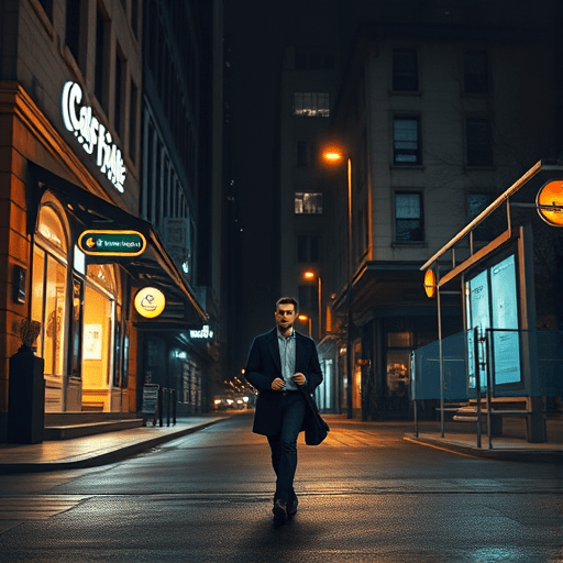
After midnight, a city stops being a backdrop and becomes a system of small decisions: which corner to cross, which bus stop to wait at, which cafe feels like a refuge instead of a trap. Finding safe 24-hour gems for solo explorers is no longer just about rumor or old forum threads. It is about knowing how to read the urban night with the right tools—local safety apps, pedestrian lighting maps, and real-time transit data—before you step out the door. This night-shift city guide treats safety as a design problem, not a matter of luck, and it will show you how to build a reliable after-dark routine in almost any city.
Build Your After-Dark Safety Stack with Local Safety Apps and Lighting Maps
A safe 24-hour city is built from small pieces of information: which block is lit, which route has late-night witnesses, and which cafe keeps its front door visible from the street. The best way to collect that information is to combine two sources that many night-shift workers overlook: local safety apps and the city’s open-data lighting maps.
Local Safety Apps That Respect the Night
Local safety apps are useful not because they predict danger, but because they pattern it. The strongest tools do not rely on panic reports alone; they also integrate sidewalk conditions, street lighting, crowd density, and even gender patterns in foot traffic. Some city-run safety dashboards let you compare blocks by risk category, while crowd-sourced apps show where people recently felt unsafe. For solo explorers, the goal is not to check a single app once. It is to build a habit of consulting the same tools the way shift workers check weather: quickly, before you leave, and again when a plan changes.
Look for apps that allow you to see warnings on a map rather than as a feed of posts. A map makes it easier to identify a safe corridor once you start moving. You can also use apps that let you share a live route with someone you trust. This is not about surveillance; it is about building a passive safety net for nights when phone batteries are low and streets are empty.
Lighting Maps Reveal What the Street Does Not Say
Lighting maps are the most underrated tool in a night-shift explorer’s kit. Many cities publish pedestrian lighting layers as open data. These maps show which side of a street has reliable illumination, where a dark gap appears between two lit blocks, and whether a “shortcut” through an alley is actually a corridor of unlit concrete. When reading a lighting map, ignore the official street names and focus on the light polygons. A cafe can be perfect inside but impossible to reach if the final 100 meters pass through a shadowed parking lot or an underpass. The map tells you which route will keep you in a continuous pool of light from the front door to the transit stop.
If your city does not publish a formal lighting map, you can create a rough version on your own. Use your phone’s night mode to take a few photos along your intended route at the same time you would normally commute. The pictures will show how much light actually reaches the sidewalk, not how much a streetlight claims to provide.
What Makes a 24-Hour Cafe a Safe 24-Hour Gem
Open-all-night signs are not a safety score. A safe 24-hour cafe should feel like a small, well-lit outpost connected to a wider street network. Before committing to a regular spot, evaluate it like infrastructure rather than interior design.
- Window placement matters. Choose a cafe where the main seating area faces the sidewalk. You want to see the street, and the street should be able to see you. A cafe buried in the back of a hotel or behind a walled courtyard may be comfortable, but it also removes you from the informal watch of late-night passersby.
- Check the staffing pattern. At 2 a.m., a single employee can be a warning sign. It is not about friendliness; it is about capacity. A safe night venue usually has at least two people working, because they can manage a restock, a bathroom break, or an unexpected visitor without leaving the front desk empty.
- Look for exits that do not require a dark hallway. If the bathroom or trash area is outside, the building has a weak point. The safest 24-hour gems keep all customer movement under the same bright ceiling.
- Position your seat near the door but not in the path of it. A seat facing the entrance gives you a clear view of anyone arriving. It also lets you keep your laptop or book in view without turning your back to the room.
It also helps to treat the cafe as part of a cluster. A 24-hour cafe across the street from a late-night pharmacy, a hotel lobby, or a transit waiting room is safer than the same cafe standing alone in a commercial district. The number of people awake nearby is part of the safety calculation, and it does not show up in a Yelp review.
After-Dark Transit Routes Must Be Tested, Not Assumed
Many night-shift workers choose a route based on the daytime schedule: the same bus, the same stop, the same habit. But after midnight, transit routes change in ways that are not obvious. Night service may skip stops, switch to a longer alignment, or operate from a different curbside position. A local transit app with real-time tracking is essential because it verifies the vehicle is actually moving before you leave the cafe. Scheduled buses do not matter if the last run was cancelled because of maintenance or an incident two hours ago.
When planning the trip, prioritize route features over convenience. A slightly longer route that keeps you on a main street with active storefronts is often safer than the shortest route through a quiet residential gap. Use the transit app to identify the nearest stop that has a bus shelter with light, not just a bare pole. If the app shows a scheduled transfer in a dark industrial pocket, look for an alternate route that arrives later but keeps you in a commercial zone for the entire trip.
The last half mile is usually the most important part of the journey. The bus may drop you close to home, but the walk from the stop to your door can take you through alleys, parking lots, or closed shopping centers. Before you get off, check the lighting map for that block. If the final segment is dark, request an earlier stop or select a stop on the far side of the street where the sidewalk catches more light.
Choose a Neighborhood with 24-Hour Gravity
Safe 24-hour gems are rarely isolated. They tend to cluster where other institutions keep the night alive: hospitals, transit hubs, 24-hour pharmacies, and hotels. When you are exploring a city under a night-shift schedule, look for these anchors on a map, then look for cafes and transit routes that fall inside their glow. A block with a hospital employees’ entrance sees regular foot traffic at all hours. A street with two all-night convenience stores has continuous motion. A neighborhood close to a major train terminal often has official nighttime waiting areas and more reliable city patrols.
This is not about choosing a “better” neighborhood in the tourist sense. It is about choosing an area with what you might call 24-hour gravity—a density of all-night services that keeps the street awake. Use safety apps to observe those blocks during the hours you plan to be there. Some neighborhoods are genuinely calm at 10 p.m. but become desolate by 3 a.m. Others, especially near late-night medical districts, stay active through the entire shift. The best way to find them is to look at the overlap between multiple signals: lighting coverage, transit frequency, and the presence of overnight businesses.
A Quick Night-Shift Route Audit for Solo Explorers
You do not need to memorize every street in the city. You need a repeatable process for checking a new route before you make it a regular habit. Run this mini audit the first time you try a new cafe, co-working space, or late-night restaurant.
- Mark the cafe on a lighting map and trace a route to the nearest active transit stop, not just the nearest stop.
- Use a local safety app to check for recent reports on that block, especially reports that cluster between 1 a.m. and 4 a.m.
- Identify two exit routes from the cafe, one familiar and one through a main street, even if it takes a few extra minutes.
- Confirm that the transit route has live vehicle tracking at your return time, and set a departure reminder that leaves a 15-minute buffer.
- Walk the route once during daylight to memorize the landmarks, then once at night without headphones. The night walk will feel different, and it will teach you which corners feel exposed no matter what the map says.
After a few of these audits, the process becomes automatic. You begin to see a city as a patchwork of lit blocks, witness-heavy intersections, and late-night outposts. The exact location matters less than the connection between the cafe door and the rest of the urban fabric.
Safety Is a Route, Not a Destination
For solo night-shift explorers, a safe 24-hour gem is not simply a place with free Wi-Fi and a good espresso machine. It is a place that anchors an entire route: a bright path from transit, a visible front door, a corridor that stays alive until you leave, and a way home that has been confirmed with real data. Local safety apps and lighting maps turn the night shift from a risky scavenger hunt into a legible system. Once you learn to read those signals, the dark hours become less about avoidance and more about informed, confident movement through the city. The best night-shift city guide is the one you build for yourself, one safe light at a time.