Satellite data procurement is no longer a simple call to a legacy aerospace giant. Today’s private providers offer a dizzying mix of optical, radar, and hyperspectral feeds, each with its own resolution, revisit cadence, and pricing. Whether you’re tracking crop health, monitoring coastal erosion, or supporting disaster response, the real challenge isn’t finding a satellite—it’s finding the right provider for your specific workflow. This guide walks through the three core negotiation pillars—resolution, revisit rates, and pricing—and adds the due-diligence steps that separate successful deployments from expensive paperweights.
Resolution: Match the Ground Sample Distance to Your Decision Boundary
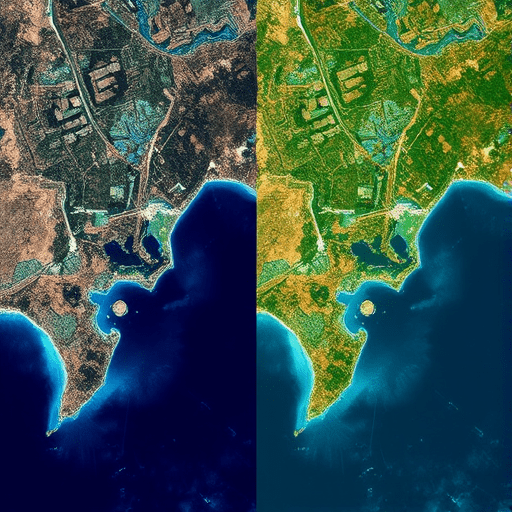
Resolution in satellite imagery is usually quoted as ground sample distance (GSD), measured in centimeters or meters per pixel. But procurement teams often make two mistakes: they assume higher resolution is always better, and they ignore the difference between spatial and spectral resolution. In 2026, commercial GSDs range from 25 cm (very high-resolution optical) down to several meters for free or low-cost sources. The sweet spot depends on the feature you need to detect.
For example, identifying individual vehicles or rift cracks in infrastructure may genuinely require 25–50 cm GSD. But monitoring vegetation stress in a 10,000-hectare farm is better served by 3-meter multispectral imagery, which provides more spectral bands and a wider swath. Purchase too much resolution and you’ll pay a premium for data that also increases storage and processing time. Purchase too little and your algorithms will fail to link pixels to the physical phenomena you care about.
Optical vs. Synthetic Aperture Radar (SAR) Resolution
A 2026-specific twist is the growing availability of commercial SAR from providers like Capella and Umbra. SAR resolution is less intuitive because it depends on aperture synthesis, not the physical mirror size. A 1-meter SAR product does not behave like a 1-meter optical image. Its return signal depends on surface roughness, water content, and geometry. When you negotiate for SAR, ask for a sample product over your region of interest, not just a spec sheet. The same GSD can look very different on a desert versus an urban grid.
Also review whether the provider offers radiometric calibration and metadata quality. You don’t just need pixels; you need consistent geolocation accuracy and timestamp precision. In 2026, many providers will happily sell you “analysis-ready” data that has been orthorectified and atmospherically corrected. That may be worth a premium if your in-house team lacks remote sensing expertise.
Revisit Rates: The Difference Between a Schedule and a Service
Revisit rate sounds simple: how often does a satellite pass over your location? But the natural revisit rate of a single satellite is rarely what you actually receive. A low-Earth orbit satellite may pass once or twice per day, but at different times and angles. Worse, optical satellites can’t see through clouds. That’s why procurement experts now ask for effective revisit—the expected number of usable images per month given weather, tasking priorities, and look-angle constraints.
In 2026, the biggest shift is from static tasking to agile tasking. Providers like Planet and Maxar now let customers request a specific take within hours or even minutes for certain areas. That changes your procurement conversation from “how many passes” to “what is your average response time for a tasking request?” Some providers also offer on-orbit subscription models where you reserve a certain number of tasking credits per month, rather than buying fixed area captures.
Constellation Coverage vs. Trade-Offs
A larger constellation generally means better revisit, but not all constellations are created equal. Some companies have hundreds of small CubeSats with a GSD of 3–5 meters, which is excellent for daily regional change detection. Others have a dozen high-resolution satellites with sub-meter GSD, yielding a best-case revisit of one to two days. Your procurement decision must balance spatial resolution against temporal density. If your application requires weekly updates of a single construction site, a high-resolution provider with flexible tasking may beat a medium-resolution daily fleet.
Commercial SAR also fills a niche in revisit rates because radar can see through clouds and at night. With companies such as ICEYE and Capella expanding their SAR constellations, you can now achieve a dependable weekly revisit in cloudy regions like the Pacific Northwest or Southeast Asia. The procurement trick is to ask for a look-angle history from the provider over your test area. If most revisits are at extreme off-nadir angles, the effective resolution and interpretability will be lower than your ideal.
Pricing Models: Move Beyond Per-Square-Kilometer Quotes
Satellite data pricing has always been opaque, and 2026 is no different. Providers list “starting at” prices that bear little relation to the final quote. That’s because the real pricing variable is not just area size—it’s the order in which you want to use the data. Raw imagery is cheaper than a processed product. A one-time archive download is cheaper than a monthly subscription. But you also need to read the licensing terms carefully.
Here are the pricing structures you’ll encounter most often:
- Per-area quote: cost per square kilometer, often with minimum purchase quantities. Common for occasional high-resolution captures.
- Subscription tiers: a fixed monthly fee for a certain number of images, tasking credits, or continuous access to a regional mosaic. Best for ongoing monitoring.
- Tasking premium: an additional fee to direct the satellite to capture your specific area at your preferred time and look angle. Sometimes called priority tasking.
- Analytics add-on: When the provider also delivers an interpreted output—like a change detection map or vehicle count—the price jumps. This is often baked into the license.
One hidden cost is licensing flexibility. If your team builds a model that uses satellite data, you may need to share derived products with downstream users. Some providers restrict that right unless you buy a redistribution license. In 2026, a growing number of government-backed open-data programs (like NASA’s Earthdata) are pressuring private providers to relax their terms. Use that environment to your advantage during negotiation.
Pricing Pitfalls Specific to Private Providers
Another trap is the minimum commitment clause. Private providers often quote an attractive unit price, but it only kicks in if you commit to a large annual volume. If your actual usage is unpredictable, you might be better off with a higher unit price and no guaranteed volume. Also check whether the provider charges extra for delivery latency. Need the data within minutes for a disaster response? That will likely cost more than a standard downlink to your ground station hours later.
Finally, examine “cloud-optimized” pricing. Some providers now deliver data directly as GeoTIFFs, COGs, or Cloud Optimized GeoTIFFs to your preferred cloud storage. That sounds optional, but in 2026 it is becoming a business model. The provider may charge more for seamless cloud streaming or charge per-step for mosaic generation. Always request a detailed line-item invoice from a pilot purchase before signing a multi-year procurement contract.
Four Critical Checks Before You Sign a Satellite Data Contract
You can compare GSD, revisit, and price all day, but successful satellite data procurement demands a quick diligence phase. Use these four checks to protect yourself from vendor hype and nasty surprises.
- Test on your own AOI: Ask the provider for an archive sample covering your exact area of interest. Run your model or at least visual inspection. No two providers process their orthorectification the same way.
- Verify SLA for tasking and delivery: The contract should state the maximum time between order acceptance and image delivery, including the penalty if that deadline is missed. For time-sensitive monitoring, set a concrete stand.
- Check export control and data residency: Satellite imagery and derived products increasingly fall under regulations like U.S. ITAR or national export controls. Know where the data will be stored and whether your international team can legally access it.
- Review the exit terms: What happens when you stop paying? Do you keep the data you have already downloaded? Can you archive it in your own cloud? Some providers retain the right to access your copies if they update their terms.
This may feel like a lot, but these checks align your procurement with the way remote sensing work is actually done in 2026—rapidly, iteratively, and with as little vendor lock-in as possible.
Conclusion
Picking a private satellite data provider today is less about the prettiest sample image and more about how the performance metrics transfer to your real-world decision-making. Resolution, revisit rates, and pricing are strings that weave through every contract, but the final weave is always shaped by your application’s tolerance for latency, cloud cover, and licensing friction. By testing samples on your actual area, negotiating effective revisit rather than nominal passes, and pushing back on hidden licensing terms, you can turn a costly procurement into a dependable stream of insights.