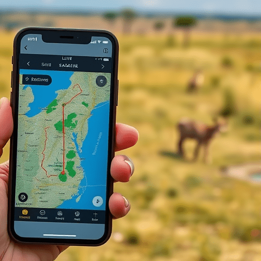
The phrase “ethical safari” has become a marketing shortcut. It appears on itineraries, lodge websites, and conservation brochures. But the more labels that pile up, the harder it is to know what is real. Learning how to verify ethical safari claims with live tracking apps is now the most practical way to separate genuine conservation tourism from a greenwashed tour. A new layer of data, pulled from geofence boundaries, camera-trap networks, and satellite-connected vehicle trackers, is changing the game.
Beyond the Brochure: Why Safari Ethics Need Live Evidence
Traditional safari credentials often rely on self-reported sustainability badges, membership in tourism associations, and beautifully designed impact reports. Those are useful, but they are rarely live. A lodge can claim support for anti-poaching while its vehicles spend afternoons driving far off-road in a protected corridor. A tour operator can brand itself as community-led while its route consistently bypasses local conservancies. Without independent, timestamped data, travelers are left trusting a marketing story instead of observing actual behavior.
This is where live tracking apps come in. They collect and display movement data from GPS devices, smartphone sensors, ranger patrols, and camera traps. Travelers can use these feeds to ask sharper questions, check tour operator claims, and make booking decisions based on evidence rather than adjectives.
Geofencing Data: See Which Boundaries Tour Vehicles Actually Cross
Geofencing creates virtual boundaries around real-world places. On a safari, those boundaries might mark a national park edge, a private conservancy, a no-driving zone, or a seasonal wildlife corridor. When a vehicle or ranger enters or leaves one of these zones, a live tracking app records the event, often with a timestamp, a route segment, and a vehicle identifier.
For travelers, this means a guide’s claim like “we never enter the restricted buffer zone” can be checked. Some tour operators now share a live map with geofence segments so guests can follow the daily route. Others publish quarterly “zone compliance” reports showing how many times vehicles stayed within approved roads and how many times they crossed into sensitive areas.
The most convincing operators treat geofencing as a public safety tool, not a private surveillance system. They explain what their vehicle alerts mean, what speed limits are enforced, and how they respond when a driver drifts. If an operator can’t produce any geofence report, or dismisses the question as “too technical,” that is a useful red flag.
Camera-Trap Feeds: The Proof in the Photos
Camera traps are motion-triggered cameras placed along animal trails, water sources, and known poaching entry points. They have been used in conservation for decades. What changed recently is how fast their data travels. Modern camera-trap networks send snapshots and short video clips over cellular or satellite links, and AI software identifies species, counts individuals, and maps animal movement in near real time.
This gives safari-goers a second verification layer. Ethical operators increasingly link their wildlife-viewing promises to camera-trap evidence. If a tour says “we helped fund the reserve’s leopard monitoring program,” there should be a public camera-trap gallery or a species identification dashboard. You can check whether the leopard IDs, dates, and locations are consistent with the operator’s story.
Camera-trap data also matters for avoiding animal welfare issues. A responsible safari respects wildlife escape distances. If a camera-trap record shows a leopard that was regularly disturbed by tourist vehicles at the same time of day, that contradiction can be visible in the data. Live tracking apps that combine camera-trap detection with vehicle GPS reveal whether tour groups are crowding a particular animal for “guaranteed sightings.”
How to Use Live Tracking Apps to Audit a Safari Operator
You do not need to be a GIS specialist to use these tools. The practical workflow is simpler than it sounds. Before booking, ask the operator one direct question: “Can you share a recent live tracking or geofence report from your vehicles?” The response tells you a lot. If they hesitate, they likely do not have the infrastructure or are not willing to be audited.
Once you have access, follow this checklist:
- Look for a dashboard or app that shows current vehicle positions, not just a static map.
- Check whether vehicles appear inside protected no-drive zones during the time of day when you would be on safari.
- Look at camera-trap or ranger patrol updates from the same reserve. Do they match the operator’s claims about wildlife activity?
- Compare the operator’s social media stories with the timestamps and coordinates in public conservation databases.
- Ask for an annual “ethical impact” summary that includes geofence compliance, camera-trap biodiversity stats, and community ranger patrol hours.
Some reserves publish open tracking portals where you can watch ranger patrols move across a landscape. The best safari operators already use these platforms internally and are happy to explain them to curious guests. That transparency is the new marker of an ethical business.
Red Flags and Green Flags in Safari Tracking Data
Not every traveler will have the time to read a full data report. But a few simple patterns can guide your evaluation.
Red flags include:
- No live tracking or geofencing capability at all on a tour that claims “advanced conservation practices.”
- Vehicle routes that repeatedly enter areas marked as sensitive, especially during calving or denning seasons.
- Camera-trap records that contradict the operator’s own sighting claims, such as “leopard seen daily” when the local camera network has no leopard detections for weeks.
- Refusal to share data with independent conservation rangers or tourism auditors.
- Marketing copy that uses terms like “wildlife corridors” but cannot explain where those corridors are or how vehicles avoid them.
Green flags include:
- Publicly available geofence boundary maps for reserves and concessions.
- Ranger patrol heatmaps showing regular anti-poaching activity.
- Camera-trap species albums with identifiable individual animals and dates.
- Vehicle speed alerts and off-road notifications integrated into a live tour app.
- Conservation reports that include transparent explanations of incidents where an operator or guide was at fault.
Getting Started: Questions to Ask Before Booking
You can start using these verification tools without downloading every new app on the market. Focus on the questions that reveal data access:
- “Do your safari vehicles carry GPS trackers, and can a guest see their route at the end of the day?”
- “Which geofencing zones apply to the areas we will visit?”
- “Does the reserve use camera traps, and is that information shared publicly or with guests?”
- “Can you show me a recent example of how you used tracking data to improve wildlife protection?”
An operator that answers these questions with specifics is likely well ahead of the greenwashing curve. One that responds with vague language about “respecting nature” is probably nowhere near a data dashboard.
The Future of Safari Verification Is Live
This season, the most forward-thinking safari operators are not just selling wildlife experiences; they are selling auditable evidence. Geofencing has become cheaper, camera-trap batteries last longer, and AI can process millions of images without slowing down. Small satellite terminals now connect remote vehicles and ranger posts, meaning data no longer disappears for weeks after a trip.
Soon, travelers will expect a live conservation feed as standard, just as they expect Wi-Fi and a cold towel after a game drive. The tours that cannot show receipts, boundaries, or ranger patrol data will struggle to call themselves ethical. The tours that embrace live tracking apps will earn the trust of a more skeptical audience.
Verifying ethical safari claims no longer requires a leap of faith. Geofencing and camera-trap data give travelers a concrete way to see what a lodge or tour operator is actually doing on the ground. When that data is shared openly, “ethical” stops being a vague promise and becomes a live, verifiable fact.