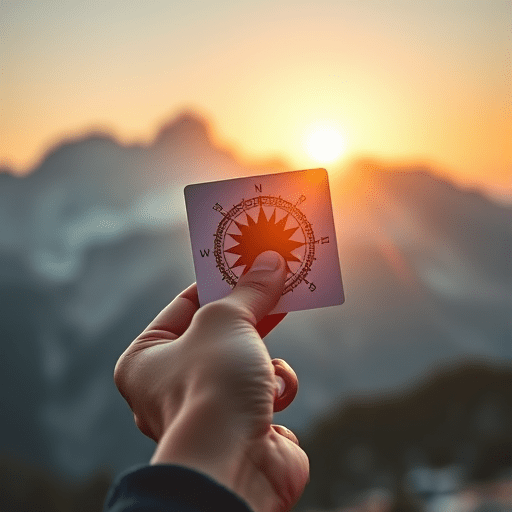
Why more hikers are ditching GPS for sun compasses is a story about resilience, not sentimentality. On remote trails from the Colorado Trail to the Scottish Highlands, a growing cohort of backpackers is turning off their satellite screens and turning toward an older tool: the humble sun compass. This isn’t a wholesale rejection of technology—most still carry a phone. But the trend toward analog navigation has gained serious traction among seasoned hikers who have experienced dead batteries, missing waypoints, or the quiet panic of a satellite fix that never arrives. What they are rediscovering is that the sun, any reasonably accurate timepiece, and a bit of geometry form a navigation system that never runs out of power and never needs a signal.
The New Vulnerability: GPS Is Not Guaranteed
For years, outdoor brands sold the idea that a GPS device eliminates fear from wayfinding. In 2026, however, the shine has worn off. Hikers have begun to speak openly about GPS dropouts in canyons, atmospheric interference, and the sobering experience of watching a battery drain to zero on the third day of a ten-day trek. More concerning still are solar disturbances and satellite outages that can degrade positional accuracy without warning. The U.S. Space Weather Prediction Center regularly issues alerts for geomagnetic storms that can knock GPS ground receivers offline for hours. For hikers deep in the backcountry, those hours are exactly when navigation precision matters most.
The weight calculator adds another nail in the GPS coffin. A handheld satellite communicator with a solar panel and backup power bank can easily add a kilogram to an already dialed-in ultralight setup. A sun compass, by comparison, is little more than a shadow-casting stick and a small, printed sun compass card that weighs under fifty grams. The difference is substantial, especially for hikers who measure their trail life in weeks, not days.
The Skill That Can’t Be Taken Away
There is also a philosophical shift at play. Many hikers realize that a GPS unit gives them directions, but it does not teach them navigation. When the screen goes dark, the mental map disappears with it. A sun compass, in contrast, forces the user to understand the relationship between time, latitude, and the sun’s apparent motion. It engages the brain rather than bypassing it. This is why a growing number of hiking clubs and outdoor schools now offer analog navigation skills workshops, with sun compass practice as the centerpiece.
How a Sun Compass Actually Works
Let’s be clear: a sun compass doesn’t magically point north. Instead, it uses a shadow cast by a gnomon (the vertical stick) to track the sun’s movement. The simplest method—the shadow tip method—requires marking the tip of a stick’s shadow, waiting fifteen minutes, marking the new position, and then drawing a line between the two marks. That line points east-west, with the first mark being west. Once you have a fixed east-west line, you can orient a proper map with your trusty baseplate compass.
More advanced sun compasses use an adjustable hour dial that aligns with your current latitude and the sun’s declination. This allows for a truly reliable bearing without a magnetic compass, which is especially valuable in magnetic rock formations like those found in the Adirondacks or the Bighorn Mountains. When you combine a sun compass with a simple wristwatch (or even a rough estimate of the time), you can determine true north to within a few degrees—an accuracy level sufficient for almost all trail navigation.
The 15-Minute Method
- Place a straight stick in level ground, making sure it casts a clear shadow.
- Mark the tip of the shadow with a pebble or a scratch.
- Wait at least 15 minutes for the sun to move.
- Mark the new shadow tip position.
- Draw a line between the two marks; this is your east-west reference.
- Use a map and a simple compass from there to take a bearing.
What makes this technique so satisfying is that it works even without a watch, as long as you can observe the sun over an hour or two. In a world of constant notifications, the slow, deliberate act of making a shadow compass is a lesson in patience—and in reliability.
Map, Sun, and Terrain: The New Analog Duo
The sun compass is rarely used in isolation. Hikers who embrace the trend pair it with traditional map-reading skills, reading contour lines, and identifying terrain features. Instead of a pin-dropping route on their phone, they spend the evening before a big day studying a waterproof topo map, marking obvious landmarks like ridgelines and river bends. Then, during the hike, the sun compass helps them maintain a general line of travel, while the map provides constant feedback.
This approach is particularly effective on remote trails with sparse signage. On the Northern Forest Canoe Trail or the Rogue River Trail, where dense overhangs can hide GPS satellites for long stretches, the ability to glance at the sun’s azimuth and then compare that with your mapped bearing has saved more than one group from a multi-kilometer detour. It also reduces reliance on fragile electronics in wet, cold, or dusty environments—places where a touchscreen gloves can be a nightmare.
What This Shift Says About Hiking Culture
The rise of sun compass use among hikers reflects a deeper cultural move from consumption to competence. In 2026, the most admired long-distance walkers are not the ones with the newest Garmin; they are the ones who can navigate a route using no more than a map, a magnetic needle, and a makeshift sundial. Social media has played a role, with hashtags like #suncompass and #analognavigation tracking thousands of posts from thru-hikers showing off their improvised shadow sticks.
Community-led workshops have sprung up in trail towns along the Pacific Crest Trail, the Continental Divide Trail, and the Hayduke Trail. These workshops teach not only the mechanics of pointing north from a shadow, but also the mental framework for navigating with incomplete information—what to do if the sun is out only at noon, or if the clouds roll in for two days. The answer is a layered approach: sun compass when visible, terrain association when not, and old-fashioned dead reckoning as a last resort.
Beyond the Wilderness
This analog revival also appeals to minimalist hikers who enjoy the puzzle of navigation, who find satisfaction in knowing why they are heading northeast, rather than merely trusting a blue dot. That mental engagement is a large part of why more hikers are ditching GPS for sun compasses in the first place: it makes the trail a richer, more participatory experience. You are not just following a route; you are interpreting the landscape.
Of course, no one is advocating for throwing all electronics out of your backpack. A fully equipped hiker will still carry a personal locator beacon for emergencies and a phone for weather forecasts and communication. But the trend toward sun compasses is a shift in mindset—a decision to treat technology as one tool among many, rather than the only tool.
The Limits of Analog: Be Honest About the Trade-Offs
The sun compass is not a panacea. It requires some skill, a visible shadow, and a basic understanding of solar time. In dense forests or during long stretches of overcast weather, it simply cannot provide a bearing. That is whyexperienced hikers_pair a sun compass with a magnetic compass and a detailed map. The sun compass is not replacing the magnetic compass; it is enhancing it. What it eliminates is the single point of failure that comes from having only one navigational method. It diversifies your toolkit.
There’s also the matter of solar time versus clock time. If your wristwatch is set to standard time but you’re hiking during daylight saving time, you’ll need to adjust. A 1-hour discrepancy translates to a 15-degree error in solar bearing—about the width of one and a half fists at arm’s length. Good sun compass instruction always includes this correction.
Another trade-off is speed. On a well-marked trail, a GPS can get you back on route in seconds. Shadow sticks take minutes to set up and read. But that “slowness” is precisely the point for many practitioners. It forces a hiker to think, to slow down, to look around, and to build a mental model of the terrain. That model is what will keep you oriented when your devices inevitably fail.
The Sun Compass Mindset Is Here to Stay
The evidence is clear: the trend toward sun compasses is not a fad or a reboot of outdated bushcraft. It is a measured, intelligent response to a world where satellites can fail, batteries can die, and the deepest valleys can swallow a 5G signal whole. Hikers are not ditching GPS because they are stubborn traditionalists. They are doing it because they have learned, through trial and error, that a shadow on the ground is the most reliable light source they will ever carry with them.
In the end, the sun compass represents the best of both worlds—the precision of a modern map and the timeless rhythm of the natural world. As more hikers step onto remote trails with nothing more than a map, a baseplate compass, and a piece of sun-bleached card, the wilderness begins to feel just a little less intimidating. It becomes not a place to be conquered with gadgets, but a place to be understood with the oldest and simplest tools we have: our own observation, patience, and skill.