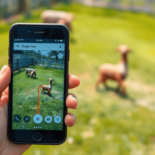
When you search for ethical wildlife tours, glossy websites and Instagram reels make every sanctuary look like a paradise. But the reality behind the fence can be very different. That’s why Google Street View: Your Weapon for Ethical Wildlife Tours – A Step-by-Step Trick to Inspect Enclosures Before You Book is the most overlooked pre-trip audit you can do. In just a few minutes, you can virtually walk the grounds, examine spatial conditions, and spot red flags before you ever hand over a single dollar. As animal-welfare awareness keeps rising in 2026, this trick is becoming a non-negotiable part of responsible travel planning.
Why Google Street View Is the Ethical Traveler’s Secret Weapon
Wildlife tourism is a mixed bag. Some venues genuinely prioritize animal welfare, but others rely on misleading marketing angles, close-up photo opportunities, and “sanctuary” labels that don’t match reality. Text reviews can be manipulated, and curated photo galleries only show the best moments. Google Street View, on the other hand, is raw, unpolished, and often years old — which is exactly why it’s so useful. It gives you a candid look at how an enclosure is structured, how much space the animals really have, and whether the environment looks built for the animals or for tourist selfies.
Unlike satellite imagery, Street View lets you get down to eye level. You can see the texture of the ground, the presence of shade, the condition of fences, and even the signs that explain visitor rules. It’s not a perfect substitute for being there, but it is a powerful filter for eliminating the worst offenders before you even open a booking tab.
The Step-by-Step Trick to Inspect Enclosures Before You Book
This is not about randomly dropping the little yellow man onto a map. It’s a deliberate method that helps you read a facility like an animal-behavior researcher. Here’s how to do it in six easy steps.
1. Start with Google Maps, not the venue’s website
Open Google Maps and search for the exact name of the wildlife attraction. Resist the urge to click through to its official site first. Instead, look at the map preview and find the venue’s labeled area. This gives you an unbiased sense of scale. Is the property surprisingly small for the number of animals they claim to house? Does the labeled boundary include only a thin strip of land? That’s your first clue.
2. Drag the Pegman to the exact entrance and parking area
The Pegman icon in the bottom-right corner of Google Maps is your best friend. Drag him onto the road nearest to the venue’s main entrance. The blue lines and dots show available Street View imagery. Start at the entrance — this is where you’ll often see the most telling details, such as overcrowded parking, entry fees displayed, or signs restricting visitor interaction. Zoom in to read any visible text on signage. You’d be surprised how much information is readable.
3. Walk the perimeter and look for enclosure clues
Once you’re in Street View, click step by step along the venue’s perimeter road or boundary. Pay attention to fences and walls. Are there large, naturalized spaces with vegetation and varied terrain, or just bare dirt and concrete? Do you see multiple animals in cramped quarters, or does the space look under-used and natural? Look for barriers that encourage respectful viewing versus fences designed for up-close photo opportunities. If the boundary is too close to a busy road, that’s a welfare red flag — no big cat deserves to sleep next to exhaust fumes.
4. Check the “inside” shots from user contributions
Street View doesn’t always cover the venue’s interior. But Google Maps often includes user-contributed Photo Spheres or 360-degree images from inside the property. These are usually linked to the venue’s listing. Tap the “Photos” section and look for blue spheres. These let you look around enclosures from the inside — sometimes showing the real conditions behind the visitor-facing facade. Compare the user-generated images to the official photos on the website. If the official images show wide, green enclosures but the user spheres show concrete pits and sparse bedding, trust the unpolished version.
5. Use historical imagery to see how the venue changed
One of the most underrated features in Google Maps is the “Timeline” or “Historical Imagery” option in Street View. In many locations, you can slide back through past years to see how the venue evolved. A formerly dirt-packed enclosure that now shows grass and climbing structures suggests genuine improvement. Conversely, an enclosure that once had trees and shade but now shows barren ground could indicate a downgrade in welfare. This historical view is a powerful way to assess whether a facility is genuinely committed to better standards or just repainting the same unsafe cages.
6. Cross-reference with Google Street View “Photo Sphere” icons
Don’t ignore the circles and small icons that appear on the map when you use Street View. These are often official 360-degree shots taken by the venue itself. While they can be glossed over, they still let you inspect angles that regular photos miss. Spin around fully and look up at the sky. Is there open roofing, or are the animals trapped under claustrophobic nets? Look down at the flooring — is it natural substrate, grass, or bare concrete? Look for enrichment items like tires, logs, and pools. The better the enrichment, the more likely the venue is investing in behavioral health, not just display.
What to Look For in an Animal Enclosure on Street View
Once you’re virtually walking through the property, keep a mental checklist of animal-welfare indicators. Not every problem is visible from the street, but several common red flags are.
- Adequate space: Does the enclosure extend far beyond what the animal actually needs? Can you see the opposite fence line? Animals that cannot retreat away from visitors are under stress.
- Natural ground: Soil, grass, leaf litter, and sand are preferable to concrete, tile, or bare hard-packed dirt. Natural substrate allows natural behaviors like digging and foraging.
- Shade and shelter: Look for trees, covered areas, or indoor access. An animal stuck in direct sun all day with no escape is a welfare disaster.
- Water sources: You can often spot water pools, troughs, or man-made streams in Street View. Clean, accessible water is a basic requirement.
- Separation from visitors: Look for double fencing, deep moats, elevated viewing platforms, or glass barriers. If the fence is just a low metal rail, you can bet the animals are forced into close contact.
- Enrichment structures: Ropes, platforms, hanging feeders, logs, and climbing frames are good signs. Empty enclosures with nothing to do lead to pacing and stereotypic behavior.
- Signage about rules: Read any visible signs in Street View. “Do not feed,” “Do not tap glass,” or “Respect quiet zones” suggest the venue is trying to manage visitor behavior.
If the Street View imagery shows several of these positive markers, you’re likely looking at a venue that understands basic animal welfare. If you see the opposite — bare concrete, no shade, tiny spaces — mark it off your list.
When Street View Isn’t Enough: Ethical Red Flags to Investigate Further
Google Street View is a powerful first line of defense, but it has limits. Imagery might be outdated, trees might block the view, or the venue might restrict photography around sensitive areas. That doesn’t mean you should give up. Use Street View to generate a list of specific questions, then ask the venue directly before booking. For example, if you can’t tell whether there’s an off-exhibit area, email and ask. A truly ethical facility will happily explain its husbandry protocols, veterinary care, and enrichment schedules.
Also look for behavioral clues that can’t be seen in static imagery. If you notice that the Street View shows a lot of pacing paths worn into the ground along the fence line, that suggests the animal spends its days pacing — a classic sign of stress. Circular or repetitive paths in dirt are a major red flag, especially for big cats and bears. You can also look for animals shown alone in species that are naturally social, or always in the same spot in different years of historical imagery.
Finally, combine Street View with recent traveler reviews that mention enclosure size, animal behavior, and visitor interaction. If a reviewer says “the lion was kept in a tiny cement pit” and your Street View confirms a small, bare pit, you have all the evidence you need to avoid that place.
Conclusion
Google Street View has quietly become one of the most practical tools for ethical wildlife tourism. It lets you step onto the ground, look through the fence, and read the real story before you book. By using this step-by-step trick to inspect enclosures, you turn a passive map feature into an active animal-protection tool. It’s not perfect, but it’s a massive upgrade from trusting a promotional website. For any traveler in 2026 who cares about animal welfare, this one habit can make all the difference between supporting a safe sanctuary and funding a roadside prison.