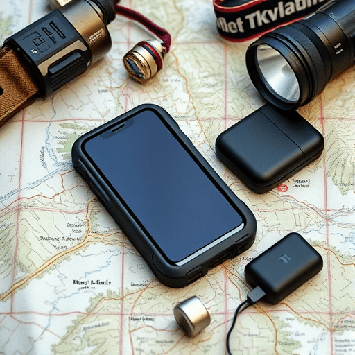
Turning a retired smartphone into a DIY GPS beacon from old phone is one of the smartest safety upgrades you can make for a solo hike signal plan. A cracked-screen Android or an old iPhone that barely powers on can become a dedicated offline emergency tracker for long trails, off-grid camps, and day hikes that turn into nights. You don’t need a satellite messenger or a brand-new GPS watch. You just need to repurpose what you already own and set it up with intention.
Before you trust it in the backcountry, understand exactly what it can and cannot do. This article explains the honest limits, the best setup, and the field-testing steps that turn an old phone into a useful emergency tool for budget thru-hikers.
Why an Offline Emergency Tracker Still Matters on a Solo Hike
A smartphone’s GPS receiver works without a cellular signal. That is the entire basis for this DIY project. When you remove the SIM card, disable mobile data, and preload topo maps, the phone becomes a pocket-sized navigation computer. It can show your coordinates, record a breadcrumb trail, and help you backtrack if you wander too far from the intended route.
The real value on a solo hike is having a dedicated backup device that is always in airplane mode and always ready to be turned on. Your main phone might be dead from taking photos, navigating town, or streaming music in a motel. Your old phone should be reserved for one job: keeping you un-lost and visible if something goes sideways.
What a DIY GPS Beacon Can’t Do
An old phone converted into an offline emergency tracker is not a satellite communicator. It will not send an SOS message through a mountain range, and it won’t alert search and rescue by itself. If you want that capability, you need a dedicated PLB or satellite messenger. But for a budget thru-hiker, a repurposed phone still provides an enormous safety advantage at almost no cost. It lets you stay on route, find your last known good position, and use a visible strobe to signal a distant search party.
Choosing the Right Retired Phone and Apps for the Job
Not every old phone deserves a spot in your pack. Start with the best device you already have that is otherwise usable. The goal is a lightweight, low-power emergency tool, not a heavy backup tablet.
Hardware Criteria to Look For
- GPS support: Choose a phone with real GPS, not just “network location.” Most Android and iPhone models released after 2015 have GPS, GLONASS, and often Galileo support. This matters in deep canyons and under dense forest canopy.
- Battery health: A replaceable battery is ideal. If the battery is swollen or drains in under two hours, replace it before you rely on it in the field.
- Durability: A cracked screen can still work, but the device should be sealed enough to handle light rain. A zip-top bag or simple silicone case is worth the weight.
- No active SIM required: Remove the SIM card so the phone never tries to roam. Airplane mode is your default state.
Apps That Turn the Phone Into a Beacon
Keep the app list short. Install only what you need, disable notifications, and test every app before the trail.
- Offline maps: Organic Maps, OsmAnd, or Gaia GPS let you download topo maps for the entire route ahead of time. Do this over Wi-Fi before leaving home.
- GPS logger: Apps like Locus Map or simple GPX loggers can record your position every 30 to 60 seconds. The log becomes your breadcrumb trail for backtracking or rescue direction.
- Strobe light: A simple “SOS strobe” app or the phone’s flashlight mode can be used to signal at night. Set this up so it is accessible from the lock screen in an emergency.
- Location sharing: If you decide to put a pay-as-you-go SIM in the old phone, apps like Google Maps location sharing or Glympse can send automatic check-ins at trailheads and road crossings.
Powering Your DIY GPS Beacon on a Multi-Day Route
The biggest challenge for a budget thru-hiker is keeping an old phone alive on a long stretch without power. The solution is a strict power budget and a small external battery.
Turn It Into a Dedicated Device
Treat the phone as a tool, not a toy. Delete social apps, disable background refresh, and leave the screen off until you need to check a waypoint. Use airplane mode at all times. Disable Bluetooth and Wi-Fi unless you are using a wireless charging accessory or a specific beaconing feature.
Set the screen timeout to the shortest interval and lower the brightness to around twenty percent. On sunny days, the screen might be harder to read, but it will still tell you the basic direction and distance to the next waypoint. Better yet, pair the phone with a tiny paper map and compass. That way you only need to power it on a few times per mile instead of holding it in front of your face.
Power Budget That Works
- Run continuously only if needed: If you need a breadcrumb trail, keep the GPS logger running but the screen off. A modern GPS logger in airplane mode can last 12 to 24 hours on a decent battery.
- Power on at checkpoints: For a more conservative approach, turn the phone on every few hours, confirm your position against the map, mark a waypoint, and turn it off again.
- Carry a 10,000 mAh external battery: That is enough to recharge a small phone several times and still weighs under a pound. You won’t have to carry a heavy solar panel if you manage usage carefully.
- Use a low-power mode: Some Android phones have an “ultra power saving” mode that restricts the phone to a small set of approved apps. This can stretch a small battery much further.
Set Up Your Solo Hike Signal Plan Before the Trailhead
A signal plan is more than a gadget in your pack. It is a set of decisions made in advance about what you will do if you get lost, injured, or delayed after dark. Here is a simple system that works with a DIY GPS beacon from old phone.
Build a Six-Step Check-In Protocol
- File a trip plan: Give a trusted person the full route, expected daily endpoints, and the date you will be back in cell service. Use the old phone as an offline copy of that route.
- Mark emergency exits: On the downloaded topo map, highlight the places where your trail crosses roads, trailheads, or known water sources. If you need help, aim for the closest exit point and write it on your rescue signal plan.
- Set a check-in schedule: Plan to send your position once a day at a place with cell service, if available. If your route is entirely off-grid, set the schedule around the last service point and the next resupply.
- Pre-program a lock-screen message: Add a note that says “EMERGENCY USE ONLY” with your name, allergies, emergency contact, and planned route. If a rescuer finds the phone, that information is immediately visible.
- Test the strobe before you need it: Practice turning on the strobe and screen-flash function in a dark room. Know exactly how many button presses it takes.
- Use waypoint memory: Mark your start point and every turn in the trail using the GPS logger. When in doubt, follow your breadcrumbs backward.
Field-Test Your DIY Beacon Before It Matters
Building the device and installing apps is only half the project. Do a full field test on a familiar day hike first. Carry the old phone as your primary navigation tool, but keep your real map and compass in your pocket as backup. This is the only way to discover small problems like a slow GPS lock, a screen that doesn’t work with wet gloves, or an app that crashes after two hours.
During the test, check three things: how long the battery lasts with the screen off, how quickly the GPS acquires a signal under trees, and how visible the strobe is from a few hundred feet away in daylight. Write down the numbers and adjust your power plan before you leave on a longer route.
As of 2026, even budget Android phones with three-year-old software are more than capable of this role. The key is to treat it as a dedicated tool, not an afterthought. Keep the setup simple, carry it in a waterproof bag, and remember that it is a supplement to a real emergency plan, not a replacement for good judgment.
Conclusion
With one old phone and a few free apps, you can build a DIY GPS beacon from old phone that fits very well into a solo hike signal plan. It won’t send text messages through a satellite, and it won’t make a rescue helicopter appear. But it will keep you on route, show you where you have been, and give you a reliable strobe light when you need to signal a distant search party. For budget thru-hikers, that is a lot of safety for almost no cost. The best gear is not always new—it is already sitting in a drawer.