Getting around a city in a wheelchair has never been as simple as following a map. A curb cut might look accessible but lead to a blocked alley; a pedestrian signal may be timed too short; a delivery truck can turn a perfectly planned route into an obstacle course. The promise of IoT wayfinding for disabled citizens is to solve precisely these unpredictable problems—and a growing number of smart city initiatives are proving that Bluetooth beacons, paired with real-time sensors, can guide wheelchairs around obstacles safely and independently. This article looks at a recent pilot in Rotterdam, where an inclusive navigation system is changing how we think about accessible urban mobility.
Why GPS Alone Isn’t Enough for Wheelchair Navigation
Traditional navigation apps rely on GPS, which works well for cars and pedestrians but falls short for wheelchair users. GPS accuracy can drift by several meters, leading to missed curb ramps or incorrect sidewalk assumptions. It also struggles in dense urban canyons, under covered walkways, and near large metallic structures. More importantly, GPS-based maps are static. They cannot see the construction barrier that appeared this morning, the parked bicycle blocking a ramp, or the restaurant that just placed a signboard across the tactile paving.
For inclusive wayfinding, the gap between the digital map and the physical world is not a minor inconvenience—it can be a serious safety risk. That is why cities are turning to IoT infrastructure that can detect and communicate immediate conditions.
Inside the Rotterdam Beacon Pilot: Wayfinding Around Live Obstacles
In the heart of Rotterdam, a pilot program known as the Accessible Route Project has been testing a beacon-based navigation system for wheelchair users since late 2025. The project focuses on a 2.5-kilometer corridor through the city center, connecting a transit hub, a hospital, and a public library—areas where unexpected barriers are common.
How the Beacons Work
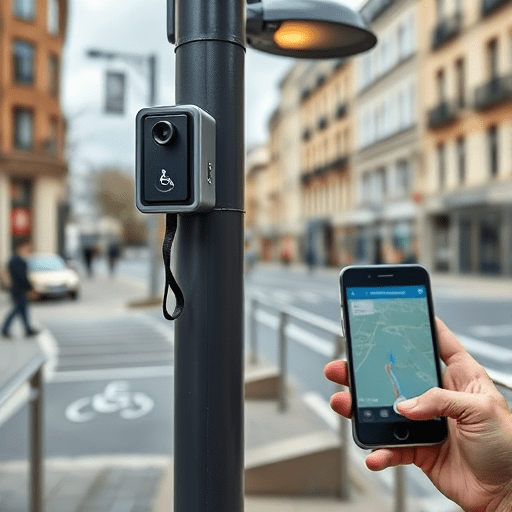
The system combines two types of IoT devices. The first is a network of Bluetooth Low Energy (BLE) beacons attached to streetlights, bus shelters, and building facades. These beacons emit a constant signal that a smartphone or a dedicated handheld unit can read, providing centimeter-level positioning even when GPS fails. The second is a set of compact ultrasonic sensors mounted on the same beacons. These sensors continuously measure the distance to objects in the surrounding area—whether that is a parked car, a temporary fence, or a delivery pallet left on the sidewalk.
When a sensor detects an obstacle on a designated accessible route, the data is sent to a central IoT platform. The platform then updates the navigation graph in real time and pushes an alert to the user’s app. If a ramp is blocked, the app instantly recalculates a route using the next available curb cut. Users receive instructions through audio, text, or haptic vibrations—no need to stare at a screen while maneuvering.
A Feedback Loop with Users
What makes the Rotterdam pilot particularly innovative is its crowdsourcing layer. The app includes a simple one-touch “report obstacle” button that lets wheelchair users flag issues immediately. Those reports are merged with sensor data and verified automatically. Over time, the system learns which obstacles are recurring and can predict high-risk zones. In one instance, a stretch of sidewalk near a construction site was being blocked every morning at the same time. Within two weeks, the system began suggesting an alternative route to users before they even reached the area.
From Individual Routes to Citywide Insight: The Digital Twin Connection
The most exciting part of this kind of IoT wayfinding is not just the immediate rerouting—it is the data trail left behind. Every obstacle detected, every reroute taken, and every user report is anonymized and fed into a digital twin of the city. A digital twin is a virtual replica of the physical infrastructure that can be used for simulation and analysis. In Rotterdam, urban planners are now using the wayfinding system to see accessibility not as a static checklist but as a living, changing condition.
For example, the wayfinding data revealed that a particular curb ramp was frequently blocked by food delivery scooters during lunch hours. Planners used that insight to adjust loading zones and add physical barriers. Another finding was that certain intersections had a high “reroute rate” during heavy rain, likely because sensors detected flooded gutters or slippery surfaces. While the system cannot control the weather, its data has prompted proposals for better drainage and alternative all-weather routes.
This feedback loop turns the IoT wayfinding network from a simple assistive tool into a diagnostic instrument for the entire city. It shifts the focus from individual adaptation to systemic improvement—a crucial step toward truly inclusive urban design.
Key Considerations for Scaling Inclusive IoT Wayfinding
The Rotterdam pilot has demonstrated the technical feasibility of beacon-driven accessibility, but scaling it citywide—or to other smart cities—requires careful attention to several factors.
- Privacy and consent: The system can passively detect a user’s position and movement. Clear opt-in rules and anonymized data handling are essential for public trust.
- Interoperability: Beacons must communicate with existing smartphone platforms and future navigation apps. Open standards for IoT data sharing are crucial. In Rotterdam, the system uses the open Mobility Data Specification to ensure compatibility with other urban mobility services.
- Battery life and maintenance: Thousands of beacons across a city require a long-term maintenance plan. The pilot uses solar-assisted batteries with a projected lifespan of five years, but remote monitoring is still needed to replace malfunctioning units.
- Accessibility of the app itself: For a navigation system to be inclusive, the user interface must be usable by people with varying levels of vision, hearing, and motor control. The Rotterdam app was designed in collaboration with disability advocacy groups, ensuring that voice commands, high-contrast visuals, and vibration patterns all work together.
- False positives and sensor calibration: Ultrasonic sensors can be triggered by birds, rain, or changes in temperature. The system must filter out irrelevant data to avoid unnecessary rerouting. Rotterdam’s platform uses a confidence threshold that requires at least two independent detections before an obstacle is confirmed.
The Road Ahead: Collaborative, Inclusive Cities
The Rotterdam pilot is one example of how IoT wayfinding for disabled citizens is evolving from a theoretical concept to a practical, data-driven urban service. Beacons do more than guide wheelchairs around obstacles; they create a continuous conversation between people, their mobility devices, and the city infrastructure. Every successful trip becomes a data point that helps planners understand where sidewalks fail, where ramps are ignored, and where temporary hazards are most likely to appear.
In 2026 and beyond, we can expect to see more smart cities adopt similar approaches, not just because it is ethical, but because it is efficient. Inclusive wayfinding reduces physical barriers, lowers the cost of last-mile mobility, and gives disabled citizens the freedom to navigate without relying on others. It is not a replacement for accessible infrastructure—it is a layer of intelligence that makes that infrastructure work better in the real, messy, ever-changing world.
The lesson from Rotterdam is clear: the next generation of accessible navigation will not be built on static maps or isolated sensors. It will be built on a collaborative ecosystem of beacons, user feedback, and city data, working together to ensure that everyone can move through the city with dignity and confidence.