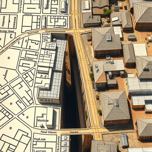
There is a peculiar pleasure in standing at a busy intersection with a phone in one hand, watching the blue dot of your position float over a city that no longer exists. The technique is simple: overlay old maps on GPS to trace lost alleys and overlooked courtyards that have been left out of modern navigation apps. When the translucent layer of a 1790s survey settles over today’s street grid, the city suddenly grows deeper, older, and far more interesting. What appears on the screen is not a historical curiosity but a practical guide for finding the hidden pedestrian gems hiding in plain sight.
In 2026, nearly every city walker carries a powerful GIS receiver in their pocket, yet most mapping software remains stubbornly focused on the present. The forgotten alleys, service passages, and courtyard networks that once connected neighborhoods are invisible to standard directions. By intentionally consulting historical maps, you can restore them to your mental model of the urban landscape, one block at a time.
Why the 1790s Map Is the Right Lens
Why the 1790s specifically? Because that decade marks a sweet spot in cartographic history. Most major Western cities had undergone at least one comprehensive survey by then, producing detailed records of streets, named alleys, plots, and public squares. At the same time, 1790s urban fabric predates three great forces that flattened countless old routes: heavy industrialization, Haussmann-style boulevards, and mid-century automobile planning.
For a North American city, the 1790s often represents the original plat before annexation and regrading erased or absorbed minor streets. For a European city, it may mean the last coherent record before Napoleonic replatting or Victorian slum clearance. In both cases, the map is large-scale enough to notice a 12-foot-wide passage but old enough to be radically different from today’s layout.
How to Overlay Old Maps on GPS in the Field
The technical barrier to overlaying old maps on GPS has never been lower. The most common route is to download a georeferenced historical map from a national library or a GIS portal, load it as a transparent layer in a mobile GIS app, and adjust the opacity until it lines up with the modern base map. Many apps now allow direct import of Web Map Service tiles, meaning you can stream an 18th-century survey exactly like you would stream a satellite view.
A practical alternative is to use a historical-layer plugin in a portable GPS device or a scavenger-hunt app that supports custom map overlays. Aligning the old map to the new one takes a few minutes: find three or four anchor points that still exist, such as a church tower, a river bend, or a surviving corner building, then scale and rotate the overlay until those points coincide.
For a low-tech fallback, simply print a section of the 1790s map, fold it into a pocket, and walk the modern grid with your GPS location open on your phone. A surprising degree of recognition happens naturally once you know what to look for: a curved property line preserved in the angle of a parking lot, a recessed doorway marking a former passage entrance, or a widened sidewalk where a lane used to run.
Calibrating expectations
Not every old map will lock onto the modern grid cleanly. Street realignment, river embankment, and building demolition can create off-sets of several meters. The goal is not perfect cartographic accuracy but enough correspondence to position yourself mentally. If the overlay seems wildly off, try matching it to a mid-19th-century map as an intermediate step, then project backward.
Lost Alleys: Traces That Navigation Apps Never Show
Once your overlay is in place, the first things to hunt for are lost alleys: narrow lanes that connected two busy streets and were later built over, gated, or absorbed into backyards. These are the urban gems that deliver the greatest delight because they so often survive in fragmentary form.
You will frequently find them encoded in modern street patterns as dead ends, L-shaped turns, or pedestrian-only paths that feel oddly out of place. A classic example is the street that suddenly narrows for one block, preserving the width of an 18th-century cart lane in the middle of a 20th-century thoroughfare. Another is the parking alley behind a row of shops; check it against the 1790s overlay and you might find it occupies the exact line of a former primary route.
Some lost alleys have become, intentionally or not, modern pedestrian shortcuts. These are the most rewarding to rediscover because they still function: a passage between office buildings, a back stair connecting street levels, or a service gate that never quite closed. Mark them on your GPS app of choice, and you will soon build a personal map of walking routes that no navigation service suggests.
Overlooked Courtyards: The City’s Hidden Backstages
While alleys are linear, courtyards are volumetric. The 1790s map shows them as open pockets within the city block, often accessible only through a narrow entrance from the street. Over the centuries, many were infilled with sheds, subdivided into tiny yards, or converted into parking courts. Yet a surprising number survive as semi-public spaces, disguised as condominium gardens, café terraces, or even small parks.
Finding them from the GPS overlay is a matter of comparing block structures. If an old map shows an open rectangular space in the middle of a block and the modern map shows a large building footprint with no visible entrance, the courtyard is still there but is now enclosed. Sometimes the entrance survives as a ground-floor opening that reads as a garage door; walking past it at street level, you would never guess it leads to a quiet square with mature trees.
In cities with strong heritage protections, these courtyards often hold clues to earlier construction methods: surviving timber-framed walls, old boundary stones, or carriage-step remnants. They also act as sound buffers and microclimate refuges, making them logical places for future small-scale urban interventions. Understanding where they once existed gives urban designers and residents alike a vocabulary for reintroducing tranquil public pockets into dense blocks.
Why This Matters for Walkability in a Changing City
This practice is more than a hobby. As pedestrianized zones and low-traffic neighborhoods expand, city planners are rediscovering that the finest granularity of a city’s walkability is often encoded in its oldest layers. Overlaying old maps on GPS can reveal routes that avoid heavy traffic, connect parks, or offer shade in the summer months, benefits that newer infrastructure rarely accounts for.
At street level, the effect is cognitively powerful. When you know that a shortcut was deliberately cut off by a 1960s road-widening project, you understand your city as a series of decisions rather than an immutable given. That knowledge changes how you navigate and, more importantly, what you notice: a fire escape that follows a former property line, a slight bend in a building facade that preserves an old lane, or a courtyard tree that is two centuries older than the apartment block around it.
Practical Steps for Your First Overlay Walk
Ready to trace your own lost alleys and overlooked courtyards? Here are the steps that tend to produce the best results.
- Choose a modest study area of about four to six blocks. Too large, and the alignment errors become distracting; too small, and you miss the larger patterns.
- Find a large-scale historical map dated between 1780 and 1810, preferably one that labels alleys and courtyards individually.
- Stick to boundary features that changed little, such as riverfronts, churches, and old city gates, as anchor points for alignment.
- Set the overlay opacity between 30 and 50 percent so the modern street names remain legible beneath the 18th-century detail.
- Take screenshots of the overlay and then put the phone away; walk the terrain, not the screen, and let the digital map guide your eyes toward physical clues.
- Carry a notebook to record each spot where the old map predicts a space that the present-day map ignores.
The Past as Pedestrian Infrastructure
In an era of algorithmic navigation, the 1790s map offers a refreshing alternative: a dataset that no app ranks, rates, or monetizes. Overlaying old maps on GPS to trace lost alleys and overlooked courtyards is not just nostalgia. It is a method for enlarging the usable city, one hidden gem at a time.
In the end, the practice reveals that every modern city is a palimpsest of earlier urban lives. Lost alleys and overlooked courtyards are not merely ruins of the past; they are latent opportunities for better walking routes, quieter public spaces, and a deeper sense of connection to the streets we inhabit. By carrying a 1790s map in your pocket in digital form, you gain access to a hidden map of the present.