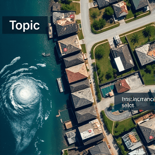
When a hurricane tears through a coastal town, the most frustrating part for homeowners is rarely the storm itself—it’s the weeks of silence that follow. In 2026, however, an increasing number of insurers are turning to satellite data for disaster claims to break that silence. Private imaging companies now capture high-resolution pictures of damaged neighborhoods within hours of a storm, and carriers are using those images to approve payouts in days, not months. For anyone new to this technology, this guide explains how private satellite imagery is changing the disaster claims process—and why it matters for your next policy claim.
Why Traditional Disaster Claims Are So Slow
The old workflow for storm damage claims follows a familiar pattern: a storm hits, policyholders file claims, and insurers dispatch field adjusters to inspect every property individually. That approach breaks down when a hurricane damages thousands of homes at once. Adjusters are forced to prioritize, travel is delayed by flooded roads, and property access may be impossible for weeks. The result is a claims backlog that stretches into the tens of thousands, and payouts that arrive just when families can least afford to wait.
The insurance industry has known about this bottleneck for decades, but only recently has the technology matured enough to offer a practical alternative. Satellite imagery, once limited to weather forecasts and military intelligence, is now commercially available with sub-meter accuracy and revisit times measured in hours. That shift is forcing insurers to rethink how they validate damage and calculate loss.
How Private Satellite Imagery Fills the Gap
Private companies like Maxar, Planet, and Capella Space operate constellations of satellites that continuously image the Earth. After a disaster, insurers contract with these providers to capture the affected region quickly. Unlike the aerial photos taken by small planes or drones, satellites can cover entire counties in a single pass, without needing airports, pilots, or local clearances.
The key advantage is speed. A satellite can be retargeted to a storm’s path before the event even ends, capturing before-and-after imagery that shows exactly which structures lost roofs, which roads are flooded, and which neighborhoods are inaccessible. This pre- and post-event comparison is the bedrock of modern catastrophe response.
Optical vs. Radar: What Kind of Satellite Data Works Best?
Not all satellite imagery is created equal. Two main types are used for disaster claims:
- Optical imagery captures high-resolution photos in visible light, similar to what you’d see from an airplane. It’s excellent for identifying structural damage—collapsed roofs, shattered windows, debris fields—when skies are clear. The downside is that clouds and smoke can obscure the view, which is common during and immediately after a storm.
- Synthetic Aperture Radar (SAR) uses radar waves to create images day or night, regardless of cloud cover. SAR can detect changes in a building’s structure and even measure ground movement. It’s especially useful in flood events, where optical sensors struggle to see through storm clouds and standing water is easy to misinterpret.
Most insurers now combine both types, using optical imagery for visible damage assessment and SAR for areas where weather hides the ground. The result is a comprehensive damage map that adjusters can use before they ever set foot on the street.
From Satellite Pass to Payout: The 2026 Workflow
To understand how this works in practice, consider a hypothetical Category 4 hurricane that makes landfall in Florida in late summer 2026. Within 12 hours, a private imaging company tasks its satellites to capture the strike zone. By 24 hours, those images are processed and delivered to the insurer’s catastrophe response team. By 48 hours, an AI-assisted analytics platform has compared pre-storm and post-storm imagery, flagging every residential structure with a detectable roof breach or water intrusion.
The insurer then cross-references those flagged properties with active claims. For straightforward cases—a missing roof deck or a collapsed wall—the claim is approved automatically, subject to random audits. More complex damage, like interior water damage or foundation shifts, is routed to a remote adjuster who reviews the imagery alongside drone footage and data from smart home sensors. In many cases, this means a settlement offer is made within 72 hours, without anyone visiting the property.
That workflow is not hypothetical. Several major insurers, including Allstate and Munich Re, have already piloted similar programs and are scaling them for the 2026 storm season. While the technology has been available for years, recent advances in AI and satellite revisit times have finally made it cost-effective for mid-size carriers.
What Faster Payouts Mean for Homeowners and Adjusters
For policyholders, the biggest benefit is obvious: money arrives sooner. Instead of waiting months for a local adjuster to schedule an inspection, families can receive an initial payment within a week, allowing them to start repairs and cover temporary housing. This is particularly crucial in low-income communities where the financial buffer is thin.
But the advantages extend beyond speed. Satellite data also introduces a level of objectivity that traditional claims appraisal often lacks. When an adjuster is standing on a soggy lawn, stress and emotion can cloud judgment. With satellite imagery, the evidence is clear: the roof was there on Monday, gone on Tuesday. Disputes over whether a hale event caused a specific leak become easier to resolve with definitive pre-and-post images in hand.
For adjusters, the technology is not a replacement—it’s an augmentation. Satellite imagery handles the initial triage, so field adjusters can spend their limited time on high-complexity claims that truly require human judgment. This reduces their workload and improves job satisfaction, which is no small matter given the chronic shortage of experienced adjusters in the industry.
Beware the Gaps: Limitations of Satellite Assessment
As useful as satellite data is, it is not a magic bullet. There are real limitations that policyholders and insurers need to understand.
- Resolution limits: Even the best commercial satellites cannot see into an attic. They can determine that a roof is damaged, but not necessarily whether the interior ceiling has collapsed.
- False positives: Shadows, building modifications, and normal wear can confuse image analysis. A new skylight might be flagged as storm damage, or a sagging carport might go undetected.
- Time lags in data delivery: While some satellites can send imagery within hours, the full processing pipeline—including georectification and AI analysis—can take days. For rapidly evolving situations, that delay can matter.
- Privacy concerns: Frequent high-resolution imaging of residential areas raises questions about surveillance, especially if the data is shared with third parties without clear consent.
These limitations are why satellite-based claims are rarely the final word. Insurers use them as a first pass, not a final settlement. Policyholders should understand that a satellite flag is not a denial; it’s merely the starting point for discussion.
A Beginner’s Action Plan for Using Satellite Evidence
If you live in an area prone to storms, you don’t need to wait for your insurer to adopt satellite technology. You can and should take steps to protect your claim before the next disaster hits.
- Document your property now: Use a smartphone or even a consumer drone to capture a detailed video of your home’s exterior and interior. This gives you your own “before” images, which can be invaluable if a satellite’s pre-storm archive is incomplete.
- Know your insurance company’s tech policies: Ask your agent whether your insurer uses satellite imagery for catastrophe claims. If they do, find out how they share evidence with policyholders and how you can challenge a satellite-based finding.
- After a storm, file promptly: The faster you submit a claim, the better the chance that your provider will have targeted satellite passes for your specific location. Delays can result in images being taken after cleanup begins, weakening the evidence.
- Use third-party satellite platforms: Services like Realtors use satellite maps for property lines, but newer platforms allow consumers to purchase recent imagery of their own address from Planet or Airbus. This can serve as independent documentation.
Finally, always keep a physical copy of your policy and a list of your insurer’s claims contacts. Technology can speed up communication, but it never replaces a human conversation when a claim gets complicated.
The Road Ahead for Satellite-Based Insurance
By 2026, satellite data has moved from a niche tool to a standard fixture in catastrophic claims management. But the industry is still in its early days. The next few years will likely bring lower costs, faster revisit times, and AI models that can distinguish between wind damage, flood damage, and pre-existing decay with even greater accuracy. For insurers, the incentive is clear: faster, fairer payouts mean lower administrative costs and stronger customer loyalty.
For homeowners, the message is equally clear: familiarize yourself with how satellite data can affect your claim. The technology is not designed to deny coverage—it’s designed to get accurate payments into the hands of people who need them, quicker than ever before. Use the tools at your disposal, keep your own records, and know that the days of waiting months for an adjuster are slowly becoming a thing of the past.