For decades, extreme athletes made split-second decisions based on experience, a quick look at the sky, and often little more than a hunch. In 2026, a new generation of AI tools that predict route hazards before you commit is flipping that equation. These systems combine hyperlocal sensor data, computer vision, and machine learning to deliver real-time risk assessments with startling precision — giving climbers, backcountry skiers, and trail runners a level of foresight that was previously impossible.
From Gut Feeling to Predictive Models: The Risk Assessment Shift
Traditional risk assessment in extreme sports has always been reactive. You check a regional weather forecast, read a guidebook, talk to locals, and then make a judgment call. But conditions in the mountains, canyons, and oceans change faster than any static forecast can capture. A sunny morning can turn into a rockfall hazard by noon; a snowpack that feels stable at one elevation can become treacherous a few hundred meters higher.
AI-driven risk assessment changes this by shifting the timeline from “what might happen today” to “what is likely to happen at this exact point, on this exact line, within the next hour.” Instead of relying on broad regional data, modern systems fuse information from local weather stations, satellite imagery, drone overflights, and even the sensors in your own gear. The result is a continuous stream of hazard intelligence that updates as conditions evolve.
This is not about replacing human judgment. It is about augmenting it with a probabilistic model that has already processed thousands of similar scenarios. The athlete still makes the call — but the call is now informed by a massive dataset instead of a single anecdote.
What Makes 2026’s AI Hazard Prediction Different
The idea of using AI in outdoor sports is not entirely new, but the current generation of tools operates in a fundamentally different way. Earlier approaches relied on cloud-connected apps that pulled static forecasts and sent push notifications. Today, edge computing and on-device models allow hazard prediction to run in near-real time, even in areas with no cellular coverage.
Wearable sensors play a major role. A climber’s smart watch can measure barometric pressure, temperature, and skin conductivity; a ski mountaineer’s avalanche transceiver can now include an inertial measurement unit that detects subtle shifts in snowpack stress. These data streams feed into on-device models that compare current readings against thousands of historical incidents. The AI does not just tell you “avalanche risk is high” — it can tell you that the specific slope you are about to traverse resembles other slopes where accidents occurred under similar loading patterns.
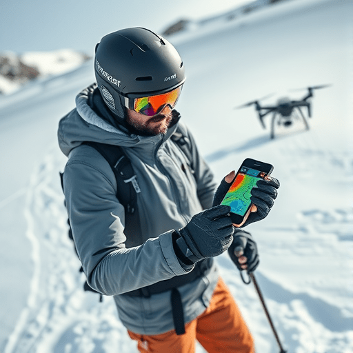
Computer vision adds another layer. Drones equipped with thermal cameras can scan a rock face for loose blocks, micro-fractures, or ice buildup. Mountaineering helmets with integrated cameras can analyze a route in real time, flagging sections where the surface texture changes or where recent rockfall has left fresh scars. These visual inputs are processed locally, meaning the AI can raise an alert before you even reach the hazardous section.
Real-Time Route Hazard Scoring: More Than a Weather App
The most practical application of this technology is the route hazard score. Unlike a simple traffic-light risk rating, a route hazard score breaks down a line into segments and assigns each one a dynamic probability of failure. For a rock climber, that might mean a numeric score for each pitch based on rock quality, recent precipitation, freeze-thaw cycles, and the presence of vegetation growth. For a backcountry skier, it might mean a slope-by-slope assessment of avalanche likelihood, glide cracks, and wind-loaded slabs.
These scores are not static. They update as the sun moves, as temperature rises, as wind shifts. A line that is safe at dawn can become dangerously unstable by mid-morning, and the AI will tell you exactly when that transition is expected to occur. This level of granularity allows athletes to plan not just where to go, but when to go, and when to walk away.
Some systems also integrate with navigation apps, overlaying hazard scores directly onto a topo map or 3D terrain model. You can see a color-coded trail where green sections indicate low probability of rockfall, yellow signals caution, and red warns of active instability. It is a powerful tool for route planning, especially for multi-pitch climbs or long traverses where one bad section can trap you.
How AI Models Learn from Near-Misses and Fatal Accidents
One of the most important innovations in 2026 is the use of incident and near-miss data to train risk models. In the past, accident reports were collected for legal and educational purposes, but they were rarely structured in a way that machine learning algorithms could use. Now, organizations are standardizing incident reports with geospatial tags, time stamps, weather conditions, and gear failure data. These records are combined with sensor logs from athletes who experienced close calls but survived.
Finding and incorporating relevant incident data is challenging because public datasets are often sparse or inconsistent. Yet the potential is enormous. A model that learns from 10,000+ avalanche incidents, including ones that did not release, can identify subtle correlations that human experts might miss — for example, a specific combination of solar radiation and wind speed that tends to precede wet slab avalanches on south-facing slopes.
The ethical dimension here is delicate. AI models are only as good as the data they are trained on, and if that data is biased toward well-documented accidents in popular regions, the tools may be less reliable in lesser-known areas. Developers are addressing this by creating open data-sharing agreements among rescue teams, guide associations, and gear manufacturers. The goal is to build a global hazard intelligence network that learns from every close call, not just the ones that make the news.
The Human Factor: Keeping Decision-Making in the Loop
As powerful as AI hazard prediction has become, there is a real risk of over-reliance. When a smartphone app says a route is safe, it is tempting to switch off your own analytical brain — even if the data feeding the model is incomplete or uncertain. In 2026, the best AI tools are designed to avoid this trap by explicitly displaying confidence intervals and data gaps.
For example, a route hazard score might come with a note that says: “Confidence: moderate — no recent seismic activity data available for this region.” That uncertainty prompt encourages the athlete to seek additional information or apply extra caution. Some systems even ask users to submit their own observations, creating a feedback loop that refines future predictions.
This is a critical balance. The point of AI is not to make decisions for athletes; it is to surface the relevant variables in an understandable format and sharpen the human decision-making process. The best outcomes occur when athletes use AI as a second opinion, not an oracle. A mountaineer who checks the hazard score, consults a partner, and then chooses a different line is using the tool correctly. One who turns off their own situational awareness and blindly follows the green route is setting up for a different kind of accident.
Challenges and Limitations in 2026
Despite the rapid advances, AI hazard prediction still has significant limitations. Data coverage is the most obvious one. Remote mountain ranges, deep canyons, and open oceans have sparse sensor networks, and models trained primarily on populated regions may offer unreliable predictions elsewhere. Connectivity is another issue; although edge computing helps, sharing real-time data among athletes in a group still requires mesh networking or satellite links, which can be expensive or unavailable.
There is also the problem of dynamic failure modes. AI can model static conditions such as rockfall probability and avalanche risk, but it struggles with fast-moving, cascading events — like a serac collapse triggered by an icefall, or a flash flood caused by a rainstorm upstream. These events depend on so many interacting variables that even the most sophisticated model can only offer a rough probability, not a precise warning.
Finally, there is the psychological risk of false confidence. If an AI tool gives a “low hazard” rating just before a tragic event, it can erode trust in the entire category of predictive tools. The industry is therefore moving toward conservative defaults, where missing data pushes the score toward caution, not optimism.
Conclusion
AI tools that predict route hazards before you commit are fundamentally reshaping the way extreme sports athletes evaluate risk. By integrating hyperlocal sensor data, terrain analysis, and machine learning models trained on real incidents, these tools offer an unprecedented depth of foresight — without removing the ultimate responsibility from the athlete. The future of extreme sports is not one without risk; it is one where every risk is understood, quantified, and respected in ways that were unimaginable a few years ago.