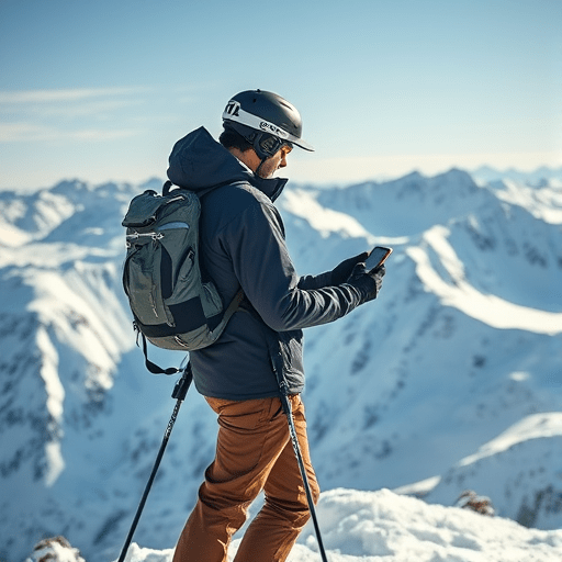
The backcountry snowpack has never been measured as precisely as it is right now. Remote weather stations stream data in near real time, satellite imagery tracks snow extent, and machine learning models digest decades of avalanche observations to produce danger ratings that are far more granular than the old regional bulletins. Yet the most important question for anyone stepping into avalanche terrain has not changed: is this specific slope safe to cross? AI avalanche forecasts are increasingly able to answer that question with surprising accuracy — but the technology is also introducing a subtle new hazard: overconfidence in a probabilistic output that still fails in the most dangerous snowpack scenarios.
From Regional Bulletins to Slope-Scale Predictions
For decades, avalanche forecasting was a spatial compromise. Forecasters collected data from remote weather stations, manual observations, and avalanche reports, then divided terrain into large forecast regions with a single danger rating. That rating told backcountry travelers everything about the general weather pattern and almost nothing about the specific slope in front of them. A “moderate” danger rating across a region a thousand square kilometers wide could hide a wind-loaded test slope that was anything but moderate.
The current generation of machine learning models is changing that compromise. By ingesting high-resolution weather models, snowpack simulation output, and thousands of recorded avalanche events, AI systems can produce slope-scale risk assessments with grid resolutions measured in meters rather than kilometers. Some European forecasting services now pair convolutional neural networks with digital elevation models to identify terrain features — convexities, gullies, wind-shadow zones — that correlate with historical avalanche starts. The result is a product that looks more like a heat map than a traditional bulletin, and it changes the conversation from “what is today’s danger rating?” to “what is the risk on that specific line?”
That shift carries real safety benefits. Slope-scale assessments catch subtle spatial variations that human forecasters, constrained by time and data, have always struggled to communicate. They also standardize risk evaluation across large geographic areas, meaning a traveler moving from one valley to the next gets a more consistent picture of how danger evolves across terrain.
The Data Problem: What Avalanche Models Actually Learn From
Machine learning is only as good as the data it is trained on, and avalanche data is notoriously messy. The challenges fall into three broad categories:
- Spatial bias: Avalanche observations are biased toward slopes that people actually travel and roads that forecasters can see. A model trained on these observations learns where avalanches are known to occur — not necessarily where they could occur. Untraveled, equally hazardous slopes remain invisible in the training set, and models tend to under-predict avalanches in terrain that is rarely visited but heavily skied.
- Rare event sparsity: Large, destructive avalanches that release on persistent weak layers are rare. A model trained on only a few dozen particularly significant cycles in a region will struggle to generalize those episodes into reliable predictions.
- Inconsistent verification: There is no standardized, sensor-based ground truth for where avalanches release naturally. Forecasters rely on human observations, satellite imagery, and occasional seismic detection, leaving large gaps in the record.
Some forecasters call this the “long-tail problem”: the most dangerous avalanche days are precisely the ones with the least training data, because they occur infrequently and under extreme conditions.
Where AI Falls Short: Wind Slabs and Persistent Weak Layers
Even with better data, certain avalanche problems remain stubbornly resistant to machine learning. Wind slabs are one example. They can form in a matter of hours on specific leeward slopes, reacting to subtle changes in wind speed and direction that weather models still resolve poorly at the scale of a single ridgeline. An AI model can identify a general wind-slab problem, but it often cannot tell you which of two adjacent couloirs was loaded overnight — the difference between a stable slope and a fatal one.
Persistent weak layers present an even harder challenge. These are deeply buried facets or surface hoar layers that can remain dormant for weeks and then trigger from a single skier’s weight on a poorly connected slope. The physics of crack propagation through a weak layer is only partially understood, and the variables that matter — grain size, layer thickness, overburden pressure — are measured at a handful of snowpit locations that may be kilometers from the slope in question. AI models can flag where persistent weak layers are likely to exist, but they consistently underestimate how much that layer’s structure varies across a single mountain face.
The Overconfidence Trap: Probability vs. Consequence
The deeper risk posed by AI avalanche forecasts is not that the models are wrong — it is that they communicate certainty in a way that encourages poor decisions in the field. A danger rating of “considerable” from a human forecaster is an invitation to think thoroughly. A slope-scale AI map showing a 38 percent probability of avalanche on a specific line looks like a dataset, and datasets invite calculation. When the probability looks low enough, the mind rationalizes the remaining uncertainty away.
This is particularly dangerous because avalanche probability and avalanche consequence are not the same thing. An AI model might accurately predict that a given slope has a low probability of producing an avalanche on a given day. But if that slope fails, the consequence is the same: burial, trauma, or death. A skier who treats a 25 percent probability as “safe enough” is making a calculation that no avalanche professional would endorse. The human brain is poorly equipped to weigh a small probability against a catastrophic outcome, and AI forecast products can make that cognitive error worse by presenting risk as a precise numerical output rather than a nuanced qualitative judgment.
Automation Bias and the Forecast Team
Forecasters themselves are not immune to overconfidence. Research on automation bias — the tendency to rely on automated recommendations even when they conflict with available evidence — suggests that avalanche forecasters who receive AI-generated risk assessments may adjust their own independent reasoning toward the model’s output. This is not necessarily bad when the model is skillful, but it creates a feedback loop: if the model misses a rare avalanche pattern, the human forecaster may be less likely to catch it because the AI output lends an aura of authority to a flawed analysis.
Forward-thinking forecasting services are responding by redesigning the human-AI interface. Some now deliberately present the model’s output as one member of an ensemble rather than a single verdict. Others require forecasters to articulate the reasoning that disagrees with the AI before they can override it. This “adversarial collaboration” is promising because it treats the machine learning model as a consultant with specialized knowledge, not as the final decision-maker.
A New Framework: AI as an Advisor, Not an Oracle
The most useful framing for AI avalanche forecasts is not “safer backcountry travel” but “better-informed backcountry travel.” The technology excels at synthesizing large volumes of data, identifying historical patterns, and scaling forecast resolution to terrain features. It remains weak at predicting the specific, localized behaviors of wind loading and persistent weak layers, and it cannot account for the human factors that drive most avalanche accidents.
Backcountry travelers should treat AI-powered slope risk assessments as a supplement to, not a replacement for, the classic toolkit: the avalanche forecast, the snowpack analysis, and on-the-ground observations. A slope-scale AI heat map is most valuable when it helps you identify which slopes deserve extra caution, not when it persuades you that a slope is safe because the model’s probability threshold falls below your personal risk comfort level. On days when the AI output conflicts with what you see in the snowpack or what your instinct is telling you about the terrain, the data is probably the first thing to question — not the last.
Conclusion
Machine learning is transforming avalanche forecasting into a genuinely slope-aware discipline, and backcountry travelers have more information at their fingertips than ever before. That information, however, is a probability, not a promise. The safest approach remains a hybrid one: let the AI map the risk surface, verify it against the snowpack, and make the final decision with the humility that every avalanche professional carries into the terrain.