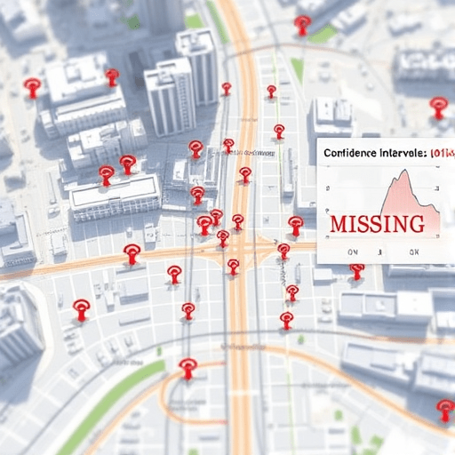
When a city-scale digital twin depends on thousands of environmental, traffic, and utility sensors, missing data is not an exception—it is a permanent condition. Yet the way your model responds to those gaps makes the difference between a reliable decision-support system and a beautifully rendered source of false confidence. This article focuses on how to handle missing sensor data in city-scale digital twins by combining pragmatic imputation techniques with a workflow that respects the unique spatial and temporal structure of urban sensing. The goal is not to chase perfect data, but to keep the twin honest when reality is incomplete.
Why Missing Data Is Inevitable in City-Scale Twins
City-scale sensor networks are messy. Malfunctioning traffic loop detectors, temporary radio interference on LoRaWAN nodes, power failures in underground air-quality monitors, and construction crews accidentally cutting fiber backhaul are just a few sources of missing data. Unlike a controlled laboratory instrument, a city sensor can disappear silently for weeks. Data gaps in digital twins also occur upstream: API feeds from transport authorities go stale, weather services deprecate fields, and third-party data providers simply change their schemas.
These gaps cannot be treated as random blanks. In an urban context, missingness often carries meaning. A street-level air quality sensor may fail during a heatwave because of thermal stress—exactly the moment when high-resolution data matters most. A traffic camera may go offline after an accident, not before it. Ignoring this correlation can lead a digital twin to underestimate congestion or miss an emerging public health risk.
Classifying Gaps Before Choosing an Imputation Strategy
Before applying any imputation technique, you need to classify the type of missingness. The standard taxonomy from statistics—missing completely at random (MCAR), missing at random (MAR), and missing not at random (MNAR)—still provides a useful starting point, but city-scale twins require a more operational lens.
- Duration: Is the gap a single reading, 15 minutes, or three months? Short gaps can often be interpolated; long gaps demand more robust methods or explicit uncertainty labels.
- Spatial context: Are neighboring sensors available? In dense urban deployments, spatial correlation is high, so nearby measurements can anchor imputation. In sparse rural-adjacent zones, you may need to rely on temporal patterns or physics-based models.
- Correlation with events: Is the missing window aligned with a known incident like a power outage or protest? If so, treat the gap as informative and avoid naive imputation that hides the event.
- Data grain: Are you missing raw readings, aggregated metrics, or metadata? The imputation strategy differs for each.
This classification step is often skipped, but it is the foundation of any practical digital twin workflow. A gap that is classified correctly can save hours of downstream debugging.
Imputation Techniques That Work for Urban Digital Twins
There is no universally best imputation algorithm for city-scale digital twins. Instead, you should build a toolkit of methods and select based on gap size, data type, and computational budget.
Deterministic Interpolation for Short, Regular Gaps
Linear interpolation has been the default for decades, and it still works well for sub-hour gaps in smooth variables like temperature or barometric pressure. For more oscillatory signals, such as traffic flow or power demand, use spline interpolation or seasonal adjustment. These methods are inexpensive and easy to explain to city stakeholders. But they fail spectacularly when the missing window is long or when the sensor is located in a microclimate far from any reference station.
Multivariate Regression and Spatial Methods
When neighboring sensors exist, spatial regression is often the first upgrade. Use a k-nearest neighbor model in sensor space, or simpler, a linear regression trained on readings from correlated sensors. For air quality, a wind direction-aware weighting scheme can improve accuracy. For traffic, incorporating the topological distance between sensors helps.
Matrix Factorization and Tensor Methods
City-scale sensor data is naturally matrix shaped: rows are time stamps, columns are sensor stations. Missing entries can be recovered using low-rank matrix factorization or non-negative matrix factorization. More advanced tensor methods add a day-of-week or seasonal dimension. These approaches work well when the entire network has a coherent structure, and they are more robust than interpolation for longer gaps. The downside is that they are less interpretable, and they can over-smooth local extremes—like a sudden spike in particulate matter after a sandstorm.
Deep Learning and Probabilistic Models
Recurrent neural networks, temporal convolutional networks, and variants like bidirectional LSTM or transformer-based imputation have become more practical in recent years. They can model long-range dependencies and nonlinear dynamics that classical methods miss. Probabilistic models like Gaussian processes or Bayesian structural time series are also attractive because they output a predictive distribution, not just a point estimate. In a digital twin, the ability to say “this value is likely between 12.3 and 14.1 µg/m³” is far more useful than a single number.
However, deep learning should not be your default tool for every missing traffic counter. The training cost, hyperparameter tuning, and risk of silent bias mean that simpler methods often provide better return on investment for routine gaps. Keep the neural imputers for high-value assets like critical infrastructure sensors or long-duration missing windows.
A Practical Workflow for Imputing Missing Sensor Data
Imputation in a city-scale digital twin is not a one-time step. It is an ongoing pipeline that must be repeatable and auditable. Here is a workflow that can be adopted incrementally.
1. Ingest with an Explicit Missingness Flag
Never silently drop missing values. Store a flag in the time-series database that marks whether a reading is observed, estimated, or missing-by-design. This transparency is essential when a downstream model produces an alert that later turns out to be an artifact of imputation.
2. Run a Daily Gap Audit
Schedule a cron job or cloud function that scans every sensor feeds and builds a missingness report. The report should include the duration, pattern, and spatial neighborhood for each gap. This audit also helps you trigger the next step automatically.
3. Select Imputation Based on Gap Classification
Create a decision table that maps gap characteristics to a preferred method. For example, a gap under two hours on a non-event day uses linear interpolation. A gap of one day with correlated neighbors uses local spatial regression. A gap of one week on a critical sensor with no neighbors uses a probabilistic imputation model. This table should be versioned and reviewed by city data officers.
4. Use a Hierarchical Imputation Strategy
Rather than choosing a single method, run imputation in stages. First, fill short gaps with interpolation. Then use spatial models for remaining gaps. Finally, apply a temporal model only to the residuals that are still missing. This hierarchical approach minimizes the risk of propagating errors from one method to another.
5. Attach Uncertainty Estimates
Every imputed value should be written to the digital twin as a range or confidence interval. For interpolation, the estimate is a simple variance formula. For deep learning, you can use Monte Carlo dropout or quantile regression. For tree-based models, use quantile regression forests. This layer of uncertainty allows simulation modules to treat imputed values differently from observed ones.
6. Reconcile with Downstream Model Performance
Track the performance of downstream use cases—traffic forecasting, air quality alerts, pedestrian flow prediction—against the imputation settings. If a new imputation method improves the weekly forecast score but increases the false positive rate of flood alerts, you need to know that trade-off. This feedback loop is the clearest justification for investing in better imputation techniques.
Validation: Knowing When Imputation Is Trustworthy
Validation is the most underused part of the workflow. The standard approach is to hide a random sample of observed values, treat them as missing, run your imputation pipeline, and compare predictions to the hidden ground truth. In the built environment, do this carefully: random masking fails to reproduce realistic missing patterns like long power outages or sensor drifts. Use pattern masking that mimics the actual missingness patterns you observe in your daily audit. Evaluate not only with mean absolute error, but also with event-level metrics. Does imputation preserve the peak of the traffic curve? Does it maintain the spatial gradient of temperature across the city?
Governance and Human Oversight
Imputation is not just a technical task. A digital twin that informs public policy must be transparent about which data points are real and which are estimated. City agencies should define thresholds for when imputed data can enter operational dashboards. For example, if more than 20% of sensor readings in a district are imputed for more than three consecutive hours, the twin should switch into “degraded mode” and require an analyst’s review before issuing alerts. This human-in-the-loop approach keeps confidence high without slowing down the entire system.
Conclusion
Handling missing sensor data in city-scale digital twins is less about finding a mathematically perfect imputation method and more about creating an adaptive workflow that detects gaps, classifies their context, selects an appropriate technique, and communicates uncertainty to every downstream model. The best digital twin is not the one with the fewest missing values; it is the one that knows exactly what it does not know and still produces useful, actionable insights for the city.