AI‑Guided Wetland Expansion Slashes Urban Carbon Footprints: How Machine Learning is Optimizing Natural Carbon Sinks for City Planners
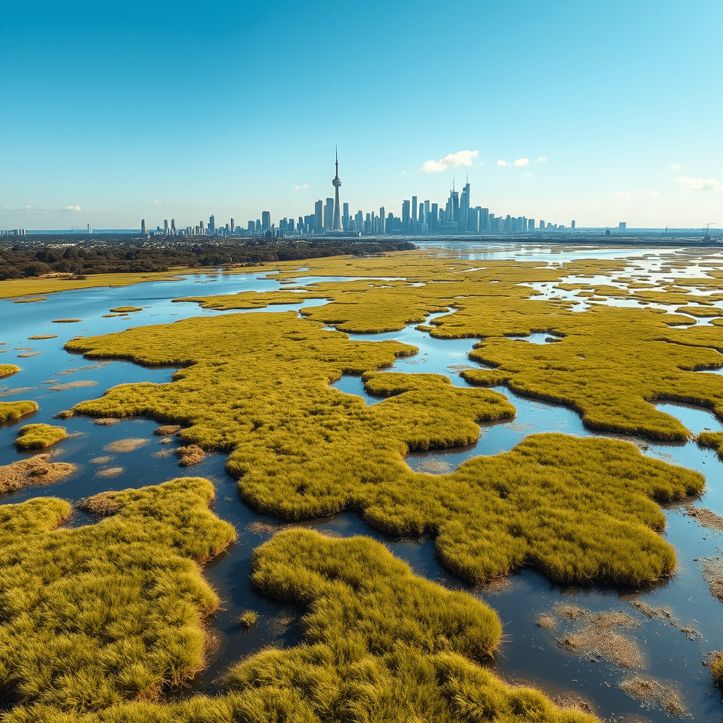
In the battle against climate change, city planners are turning to an unexpected ally: AI‑guided wetland expansion. By leveraging machine learning to identify the best sites, design the optimal wetland geometry, and monitor carbon sequestration in real time, municipalities can turn pockets of unused land into high‑yield carbon sinks. This approach not only reduces urban carbon footprints but also delivers co‑benefits such as flood mitigation, biodiversity restoration, and improved air quality.
Why Wetlands Matter for Urban Carbon Management
Wetlands are among the most efficient natural carbon sinks on the planet. Their unique hydrology and diverse plant communities trap and store organic matter, turning it into stable peat or soil carbon. In urban settings, wetlands are often undervalued or neglected, yet they can play a pivotal role in meeting net‑zero goals.
- Carbon Sequestration – Wetlands capture up to 50 g C m⁻² yr⁻¹, surpassing many forested landscapes.
- Flood Protection – By absorbing stormwater, wetlands reduce flood risk and protect infrastructure.
- Biodiversity Hotspots – Urban wetlands provide habitat for pollinators, birds, and aquatic species.
- Water Quality – Natural filtration removes nutrients and pollutants before water reaches rivers and lakes.
Challenges of Traditional Wetland Projects
While the benefits are clear, conventional wetland development often faces hurdles: limited data on site suitability, uncertain carbon budgets, long planning cycles, and the risk of engineering failures. Manual mapping and design can miss hidden opportunities or lead to suboptimal configurations that fail to maximize carbon capture.
Enter AI: Machine Learning for Wetland Expansion
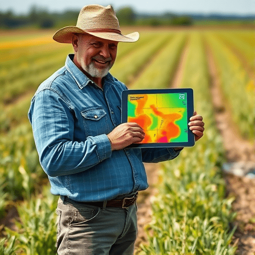
Artificial intelligence transforms the wetland planning process by providing data‑driven insights that humans alone cannot produce quickly or accurately. Machine learning models can analyze vast datasets—from satellite imagery and LiDAR to soil maps and hydrological simulations—to predict which areas will yield the highest carbon sequestration when converted into wetlands.
Key AI Techniques in Wetland Design
- Deep Convolutional Neural Networks (CNNs) – Identify potential wetland sites from high‑resolution aerial photos, highlighting subtle topographic cues that signal low‑lying, water‑retentive zones.
- Random Forests and Gradient Boosting – Rank the importance of environmental variables (e.g., proximity to streams, soil pH, land use history) in determining site suitability.
- Reinforcement Learning – Optimize wetland shape and planting schemes by simulating multiple design iterations and learning the configuration that maximizes carbon uptake over time.
- Generative Adversarial Networks (GANs) – Create realistic scenarios of wetland evolution under climate change, informing long‑term resilience planning.
From Data to Decision: The AI Workflow
1. Data Collection – Gather multi‑source geospatial layers: elevation, hydrology, soil type, land cover, and climate projections.
2. Model Training – Use historical wetland sites as ground truth to train predictive algorithms.
3. Site Scoring – Generate a suitability map highlighting top candidates for wetland conversion.
4. Design Optimization – Employ reinforcement learning to determine optimal layout, plant species mix, and water flow paths.
5. Carbon Projection – Run carbon budget simulations to estimate sequestration over 10, 20, and 50‑year horizons.
6. Monitoring & Feedback – Deploy remote sensing and IoT sensors to track water levels, vegetation health, and actual carbon storage, feeding data back into the model for continuous refinement.
Case Studies: AI‑Guided Wetland Successes
1. Rotterdam, Netherlands
Facing frequent flooding and a citywide carbon reduction mandate, Rotterdam’s municipal agency partnered with a Dutch tech firm to develop an AI model that mapped 1,200 potential wetland sites across the city. The model incorporated sea‑level rise projections and urban heat island data. By 2025, the city had implemented 45 hectares of AI‑designed wetlands, sequestering an estimated 12,000 tonnes of CO₂ annually and reducing flood risk by 30% during peak storm events.
2. Singapore’s “Garden City” Initiative
Singapore integrated AI into its “Garden City” program to identify rooftops, abandoned lots, and riverbank areas suitable for constructed wetlands. The AI system ranked sites based on accessibility, existing infrastructure, and potential carbon yield. The result was a network of 30 wetland parks that collectively sequestered 7,500 tonnes of CO₂ by 2024 and provided recreational green spaces for over 2 million residents.
3. Los Angeles, California
In a partnership with a leading environmental AI startup, Los Angeles used machine learning to retrofit abandoned storm drains into living wetlands. The AI model considered groundwater recharge rates and local biodiversity indices. Over a five‑year period, the initiative reduced the city’s urban carbon footprint by 1.2% and improved water quality in the Los Angeles River basin.
Practical Steps for City Planners
Step 1: Build a Multidisciplinary Team
Effective AI‑guided wetland expansion requires collaboration between ecologists, data scientists, hydrologists, urban planners, and community stakeholders. Form a core working group that defines objectives, data requirements, and success metrics.
Step 2: Secure Data Infrastructure
Invest in high‑resolution GIS layers, cloud storage, and computational resources. Publicly available datasets (e.g., USGS, ESA Sentinel) can be complemented with proprietary LiDAR or UAV surveys for finer detail.
Step 3: Choose the Right AI Tools
Open‑source libraries such as TensorFlow, PyTorch, and Scikit‑Learn provide flexibility, while commercial platforms (e.g., ArcGIS AI, Google Earth Engine) offer streamlined workflows. Ensure the chosen solution can handle the scale of urban datasets and produce interpretable results for policy decisions.
Step 4: Pilot and Iterate
Start with a small pilot site to test the AI workflow, validate predictions against ground truth, and refine the model. Use pilot outcomes to secure additional funding and build public support.
Step 5: Integrate with Policy and Funding Mechanisms
Align wetland projects with existing climate action plans, green infrastructure mandates, and carbon credit schemes. Demonstrating a clear carbon budget and return on investment can unlock municipal bonds, federal grants, or private partnerships.
Addressing Common Concerns
- Data Privacy – Ensure all datasets comply with local privacy regulations; anonymize sensitive information.
- Model Transparency – Use interpretable models where possible and provide visual dashboards for stakeholders.
- Maintenance Costs – Incorporate long‑term monitoring and maintenance budgets into the project cost.
- Community Acceptance – Engage residents early through workshops, citizen science, and educational outreach to showcase environmental benefits.
The Future: AI, Wetlands, and Climate Resilience
As machine learning models become more sophisticated, they will increasingly incorporate real‑time data streams, climate model outputs, and socio‑economic variables. The vision is a self‑optimizing network of urban wetlands that dynamically adapts to changing conditions, providing continuous carbon sequestration and ecosystem services. By embedding AI into the urban planning lifecycle, cities can transform neglected spaces into resilient, climate‑friendly assets.
In a world where every ton of CO₂ matters, AI‑guided wetland expansion offers a tangible, nature‑based solution that aligns ecological health with urban sustainability. City planners who embrace this technology are not only cutting carbon emissions but also building healthier, more livable communities for future generations.
Ready to transform your city’s landscape into a living carbon sink? Explore AI‑driven wetland projects and unlock the full potential of urban nature.