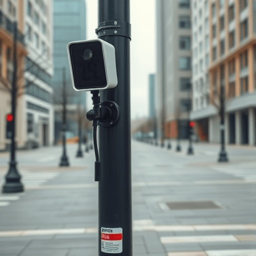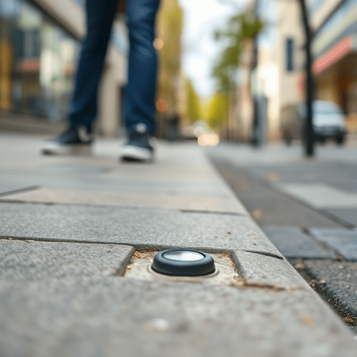
Across the temperate neighborhoods of Wrocław, the riverfront corridors of Ghent, and the sprawling suburbs of Phoenix, an unlikely revolution is happening at curb level. Tiny, low-power IoT sensors embedded in pedestrian footpaths are quietly collecting footfall counts, dwell times, wheelchair pass-throughs, and even surface temperatures. While autonomous vehicles and high-profile smart-city dashboards tend to dominate headlines, it is this granular, ground-level telemetry that is reshaping urban mobility plans in 2026. The result is a new era of pedestrian-first infrastructure, designed less by assumption and more by what the sidewalk actually experiences every day.
Why Curbside IoT Matters More Than Vehicle-Centric Sensors
For decades, urban mobility planning has skewed toward the needs of cars. Traffic loop detectors, GPS-based traffic feeds, and license-plate recognition systems have given planners a near-obsessive view of vehicular flow. Pedestrians, by contrast, were estimated, sampled in short surveys, or extrapolated from outdated census data. That asymmetry is finally changing. Sidewalk-embedded sensors — often pressure-sensitive pads, thermal arrays, or radar micromodules — can capture the volume, speed, and type of activity on a footpath continuously and anonymously.
City engineers are now using this data to answer deceptively simple questions that have long resisted measurement: Which corners do people actually use to cross? How long do commuters wait at a poorly timed signal? Where do mobility scooters, parents with strollers, and joggers share space uncomfortably? When planners know the answers, design changes can follow within a single budget cycle rather than a decade-long guess.
Case Study 1: Wrocław — Tuning Crossings to Real Walkers
Wrocław, a Polish city of roughly 640,000 residents, deployed curbside IoT units at 38 intersections in late 2024. By early 2026, the city’s mobility office had rebuilt signal timing at nine crossings using anonymized pedestrian dwell times and gap-acceptance behavior.
The most striking finding was that two busy crossings near tram interchanges had pedestrian wait times that averaged 47 seconds during weekday peaks. Sensors revealed that older residents and parents with children consistently abandoned the crossing mid-walk when vehicles turned unexpectedly. The city’s response was twofold: extending pedestrian phases by six seconds during the morning peak and adding tactile guidance strips. Six months on, mid-crossing aborts dropped by 31 percent, and complaints to the city’s 311-style service fell by a similar margin.
Case Study 2: Ghent — Counting Strollers, Scooters, and Wheelchairs
Ghent’s mobility team took a different angle. Rather than focus on speed and volume, they installed multimodal classification sensors that can distinguish between standard walking pace, mobility aids, bicycles, and e-scooters passing over shared paths. The resulting dataset, managed under strict data minimization rules, exposed a long-suspected truth: the city’s beloved riverside path was operating well above its comfortable capacity on weekends.
What changed? Instead of widening the path — which would have required costly riverbank work — Ghent introduced a dynamic lane-management scheme. During weekday commuting hours, the path favors bicycles and e-scooters. On weekends, signage and pavement markings shift to prioritize pedestrians and families. Sensor data validated the redesign within weeks, showing a 22 percent reduction in conflicts between user types during peak weekend hours.
Case Study 3: Phoenix — Heat-Aware Walkability
Phoenix’s contribution to the sensor-literate sidewalk movement is perhaps the most climate-specific. The city combined footfall counters with surface temperature sensors to map how heat affects pedestrian route choice during the long summer months. The data confirmed what residents already knew: many simply avoided certain blocks entirely when temperatures exceeded 45°C.
The mobility office partnered with parks departments to install shade structures and misting features along three identified corridors. The result was not a vanity project. Sensor data showed that pedestrian volumes on those corridors climbed by 18 percent during afternoon hours once shading was in place, while nearby unshaded routes saw volumes flatten. The city is now applying the same methodology to identify priority routes for future tree-canopy investment, turning comfort metrics into a planning tool.
Common Threads: What Makes These Programs Work
Looking across all three cities, several shared principles stand out:
- Anonymization by default. None of the programs collect personally identifiable information. Sensors count presence, not identity, which sidesteps the most common public objections.
- Short feedback loops. Each city acted on data within months, not years. That rapid cycle builds political will for further investment.
- Equity considerations baked in. Planners explicitly mapped under-served neighborhoods to ensure that sensor investments didn’t only enrich already well-served districts.
- Open data commitments. Aggregated, non-personal data is published openly, allowing academics and civic groups to validate city conclusions independently.
Challenges That Remain
Despite the optimism, the curbside IoT approach is not without friction. Maintenance costs for embedded sensors can be higher than expected, especially in climates with freeze-thaw cycles. Calibration drift — where sensors slowly lose accuracy — requires scheduled validation against manual counts. There are also unresolved questions about long-term data retention and the risk of mission creep if richer datasets are later aggregated with other city systems.
Privacy advocates in all three cities have welcomed the minimal-data approach but continue to monitor expansions. The lesson so far is that pedestrian sensing succeeds when the public sees the benefit reflected in their daily environment: shorter waits, safer crossings, cooler routes, and clearer shared-path markings.
What Other Mid-Sized Cities Can Learn
For mid-sized cities considering similar programs, the three case studies suggest a pragmatic starting point. Begin with a handful of high-friction intersections rather than blanketing an entire downtown. Combine pedestrian counts with at least one contextual variable — temperature, mode, or time of day — to make the data actionable rather than abstract. And treat the first deployment as a learning instrument, not a finished product.
The broader implication is that urban mobility planning is quietly becoming a discipline of measurement rather than assumption. As sensors become cheaper, battery lives extend, and edge processing handles privacy concerns locally, the sidewalk itself is becoming a source of evidence. That shift may do more for walkable, equitable cities than any single flagship project.
Sensor-literate sidewalks are not a futuristic vision. In Wrocław, Ghent, and Phoenix, they are already reshaping curbs, crossings, and corridors in ways that residents can feel underfoot. The path forward for urban mobility will increasingly be informed by the people who walk it.