The rise of Urban Soil Sensors and Smart Trees is transforming parks, streetscapes, and planted medians into a distributed biosensor network capable of forecasting floods, droughts and heat islands and triggering low-energy, targeted IoT responses that protect people and infrastructure.
Why soil and trees are the city’s best sensors
Soil and trees are living record-keepers of a neighborhood’s hydrology, temperature and stress. Soil moisture and temperature respond immediately to rainfall and evaporation; root-zone oxygen and electrical conductivity signal saturation or salinity; tree sap flow and leaf temperature reveal plant stress from drought or heat. When sampled at scale, these natural signals provide spatially dense, high-fidelity indicators that complement weather stations, cameras and remote sensing.
Advantages over traditional sensors
- Fine-grained spatial coverage—sensors in street trees and planters fill gaps between meteorological stations.
- Early detection—root-zone conditions change before surface flooding or canopy dieback becomes visible.
- Low energy and simplicity—many biosensor modules are optimized for intermittent sampling and energy harvesting.
- Co-benefits—sensor-equipped green infrastructure still performs stormwater, shade and biodiversity functions.
Core components of a biosensor network
An effective urban biosensor system combines simple field hardware, resilient edge computing, and an event-driven orchestration layer:
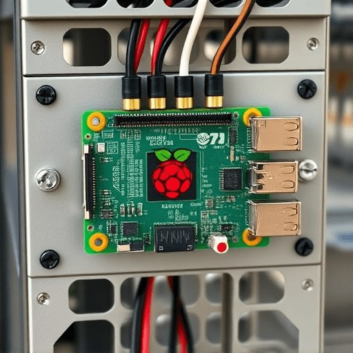
- Field nodes—soil moisture probes, temperature sensors, sap flow or trunk micro-thermal sensors, and low-power tilt or conductivity sensors placed in tree pits, planters, and rain gardens.
- Connectivity—LPWAN (e.g., LoRaWAN) or mesh networks to preserve battery life and scale to thousands of nodes.
- Edge intelligence—local microcontrollers that pre-process data, apply drift correction, and only transmit anomalies to reduce data transfer and energy use.
- Orchestration—cloud or municipal platforms that fuse biosensor inputs with weather forecasts and hydrologic models to trigger actions.
- Actuators—micro-irrigation valves, green-infrastructure gates, shade misters, or adaptive signage that respond to alerts.
How the network forecasts floods, droughts and heat islands
Flood forecasting
Rapid rises in root-zone moisture and saturation signals in multiple nodes across a watershed indicate soil has reached field capacity—often hours before surface runoff overwhelms drains. By combining those observations with short-term radar or radar-nowcast precipitation and local slope models, the system flags neighborhoods at imminent flood risk so stormwater valves, traffic routing, and targeted alerts can be enacted.
Drought detection
Persistent low sap flow and declining soil moisture are early warnings that trees and pervious surfaces are entering hydric stress. The network enables graded drought responses: from delay-tolerant scheduling of municipal irrigation to priority watering of street canopies that reduce heat stress for vulnerable residents.
Heat island monitoring
Leaf and trunk temperatures, paired with soil moisture and ambient sensors, reveal pockets of intense urban heating. Localized actuator responses—temporary misting in transit stops, deploying pop-up shade canopies, or activating reflective pavement treatments—can be triggered selectively, concentrating limited cooling resources where they matter most.
Design strategies for cities
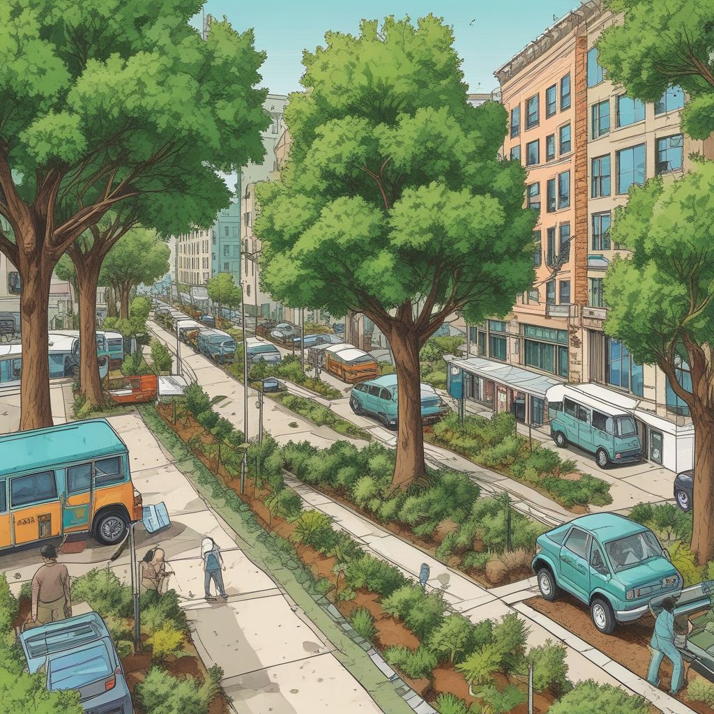
- Sensor placement—prioritize tree-lined corridors, schoolyards, flood-prone blocks and heat-vulnerable neighborhoods to maximize equity and impact.
- Redundancy and calibration—cluster sensors in small groups to reduce false positives and run seasonal calibration routines using reference probes.
- Energy strategy—use sleep cycles, energy harvesting (solar on lamp posts) and adaptive sampling that increases frequency only during events.
- Interoperability—adhere to open data standards (e.g., OGC SensorThings API) so municipal systems and community apps can integrate data.
Targeted, low-energy IoT responses
One of the most compelling aspects of a biosensor network is the ability to trigger precise, low-cost actions rather than blanket measures:
- Micro-irrigation that waters the root zones of at-risk trees for short durations rather than running whole-block sprinklers.
- Automated stormwater bypasses that route overflow to vacant lots or detention cells when sensors indicate upstream saturation.
- Localized cooling interventions—short-duration misters, shading deployment, or temporarily reducing waste heat from traffic signals—targeted to hotspots flagged by tree sensors.
- Priority dispatching of urban forestry crews to trees showing early stress signals, preventing canopy loss.
Challenges and best practices
Operationalizing these networks requires attention to sensor durability, data governance, and community engagement. Sensors must withstand vandalism, compaction and seasonal variability; edge algorithms must be robust to noise and drifting baselines; and privacy rules must limit inference about individual behavior from environmental data.
Community and equity considerations
Deployments should be co-designed with residents, giving neighborhoods access to dashboards and control over local actuator policies. Prioritizing under-served areas maximizes social return—trees and permeable surfaces deliver the greatest cooling and flood mitigation benefits where the built environment is densest and resources are scarcest.
Maintenance and lifecycle
Adopt a maintenance plan: annual calibration, battery cycle tracking, and modular field nodes that are replaceable without heavy equipment. Planning for lifecycle costs—installation, telemetry, software and labor—ensures sustainable operations beyond pilot phases.
Pilot checklist for city planners
- Map priority zones: flood-prone streets, heat islands, and vulnerable populations.
- Select robust, low-power sensors with open protocols.
- Design edge rules that minimize transmissions and false alarms.
- Plan actuator integrations: valves, misters, signage, and maintenance workflows.
- Establish data governance: public dashboards, privacy safeguards, and open APIs.
Cities that invest in Urban Soil Sensors and Smart Trees gain a proactive, nature-integrated early warning system that reduces emergency response costs, preserves tree canopy, and targets scarce cooling and irrigation resources where they make the most difference.
Conclusion: By turning green infrastructure into a distributed biosensor network, municipalities can detect floods, droughts and heat islands earlier and respond more efficiently with low-energy, targeted IoT actions that protect both people and ecosystems.
Ready to pilot a biosensor network in your city? Contact your urban forestry or sustainability office to start a neighborhood-scale trial.