In the evolving landscape of sustainable agriculture, AI soil carbon mapping guides smallholder reforestation efforts by turning vast amounts of field data into actionable planting strategies. Smallholders, who often operate with limited resources, now have access to machine learning models that predict soil carbon levels with sub-meter precision. This shift empowers farmers to identify the most carbon-rich zones, prioritize tree species, and allocate labor efficiently, all while maximizing climate benefits.
Why AI Soil Carbon Mapping Matters for Smallholders
Traditional reforestation projects frequently suffer from overgeneralization—planting the same species across a landscape regardless of soil conditions. AI-enabled mapping corrects this by revealing micro-variations in soil carbon, moisture, and fertility. For smallholders, the benefits include:
- Resource Optimization: Targeting areas where trees can thrive reduces seedling loss and labor costs.
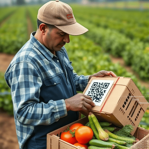
- Enhanced Carbon Credits: Precise mapping ensures compliance with certification standards, opening revenue streams.
- Risk Mitigation: Predictive insights help avoid planting in marginal soils prone to erosion or nutrient depletion.
Integrating Climate Goals with Economic Objectives
By aligning reforestation with carbon accounting, farmers can demonstrate measurable climate impact while expanding market access. AI tools enable transparent reporting, a critical factor for buyers and cooperatives seeking verifiable sustainability credentials.
Core Technologies Driving AI Soil Mapping
The convergence of remote sensing, edge computing, and machine learning forms the backbone of AI soil carbon mapping. Below are the key components that smallholders can deploy:
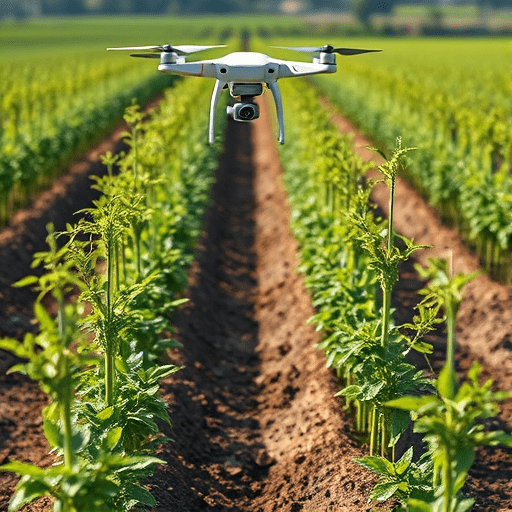
- Drone-Based Multispectral Sensors: Capture high-resolution imagery that reveals soil composition and moisture gradients.
- Satellite Constellations (e.g., Sentinel-2, PlanetScope): Provide repeatable, global coverage for baseline mapping.
- In-Situ Soil Sensors: Collect temperature, pH, and carbon content in real-time, feeding data into AI models.
- Edge AI Processors: Enable on-farm data analysis without reliance on cloud connectivity.
These technologies synergize to produce a layered dataset that machine learning algorithms can ingest and interpret.
Implementing AI Soil Carbon Mapping on a Small Farm
Deploying AI-driven mapping requires a stepwise approach that balances cost with impact. The following roadmap outlines best practices for smallholders:
- Baseline Data Collection: Begin with a simple drone survey covering the entire field, capturing RGB and NIR bands. Pair this with a few in-situ soil samples.
- Model Selection: Choose a pre-trained convolutional neural network (CNN) fine-tuned on similar agro-ecological zones. Many open-source models exist that can be adapted to local conditions.
- Calibration: Use the in-situ samples to calibrate the model’s predictions, adjusting for local soil types and vegetation.
- Visualization: Export the resulting carbon density heatmap to a GIS platform or a mobile app that farmers can navigate on their smartphones.
- Planning: Overlay desired tree species’ soil preferences onto the heatmap to generate a planting plan that maximizes both survival and carbon uptake.
Throughout this process, training and capacity building are essential. Partnerships with local agricultural extension services or tech hubs can provide hands-on workshops and support.
Integrating Traditional Knowledge with AI Insights
AI mapping should complement, not replace, farmers’ indigenous knowledge. Field observations—such as microclimate patterns or historic yields—provide context that models may overlook. Encouraging dialogue between data scientists and farmers ensures that AI outputs are interpretable and actionable.
Targeted Reforestation: From Data to Planting
Once the AI-generated map is ready, the next phase is translating data into a planting schedule. The key steps include:
- Species Matching: Cross-reference carbon density hotspots with tree species that thrive in those soils. For instance, nitrogen-fixing Acacia might be ideal in low-carbon zones, while fast-growing Eucalyptus suits higher-carbon areas.
- Spacing Algorithms: Use the model to determine optimal tree spacing that balances canopy cover with soil carbon retention.
- Phased Implementation: Prioritize high-value zones for initial planting, allowing for monitoring and iterative adjustments.
- Monitoring Protocols: Deploy low-cost soil sensors and drone flights post-planting to validate model predictions and track growth.
By following a data-informed roadmap, smallholders can reduce waste, accelerate carbon sequestration, and improve ecosystem resilience.
Case Study: A Kenyan Tea Estate
A smallholder tea estate in Kenya applied AI soil carbon mapping to identify 20% of its land where carbon density was unusually high. The farm then planted a mix of native forest species, achieving a 30% increase in canopy cover within two years. The resulting carbon credits helped secure a supplemental income stream, illustrating the tangible benefits of targeted reforestation.
Success Stories & Lessons Learned
Across the globe, several projects demonstrate the power of AI in smallholder reforestation:
- India’s Deccan Plateau: Farmers used drone imagery to map soil carbon and selected drought-resistant species, improving both yield and carbon capture.
- Brazil’s Cerrado: Remote sensing data guided a community tree-planting initiative, leading to a 15% increase in biodiversity.
- Kenya’s Homa Bay County: A partnership between a university and local cooperatives leveraged edge AI to produce near real-time soil maps.
Common lessons include:
- Start small and scale up—pilot projects validate models before full deployment.
- Invest in farmer training—data literacy is as crucial as technology adoption.
- Establish monitoring loops—continuous data collection refines model accuracy over time.
Overcoming Barriers & Scaling Up
Despite its promise, AI soil mapping faces hurdles that smallholders must navigate:
- Cost of Equipment: Drones and sensors can be prohibitive. Cooperative purchasing or micro-financing options can lower entry barriers.
- Digital Literacy: Technical know-how is necessary for data interpretation. Partnerships with local NGOs can bridge this gap.
- Data Privacy: Farmers need assurance that their data won’t be misused. Clear data governance policies are essential.
- Infrastructure: Reliable internet is often scarce. Edge AI solutions mitigate connectivity constraints.
Scaling requires a supportive ecosystem: governments can offer subsidies for precision tools; extension services can provide ongoing technical assistance; and market mechanisms can reward carbon-friendly practices.
The Future of AI-Enabled Soil Carbon in Smallholder Reforestation
Looking ahead, several emerging trends will shape the field:
- Hybrid Models: Combining satellite, drone, and ground-based data will improve spatial resolution and predictive accuracy.
- Community Data Platforms: Shared databases allow farmers to benchmark their carbon footprints and collaborate on best practices.
- AI-Driven Policy Simulations: Models can forecast the impact of policy changes on carbon markets, guiding farmer decisions.
- Integrating Climate Resilience Metrics: Beyond carbon, AI can evaluate how reforestation supports water retention and pest control.
As technology matures, the barrier to entry will continue to fall, enabling even the most resource-constrained farmers to harness AI for sustainable reforestation.
In summary, AI soil carbon mapping transforms reforestation from a broad-brush activity into a precise, data-driven strategy. By leveraging advanced sensing, machine learning, and farmer expertise, smallholders can maximize carbon sequestration, improve yields, and secure new revenue streams—all while contributing to global climate goals.