The rise of the urban climate twin is transforming how cities anticipate and respond to heat stress: by coupling hyperlocal microclimate simulations with mobility and social data, Urban Climate Twins can forecast heat-stress hotspots and help prioritize targeted cooling interventions that protect vulnerable communities.
Introduction: Why we need Urban Climate Twins now
Cities are heating unevenly. Tree-lined avenues, open plazas, dense corridors of asphalt and glass — each creates distinct thermal signatures that change hour by hour. Traditional heat maps, often coarse and static, miss the social dynamics that make some neighborhoods more vulnerable than others. Urban Climate Twins integrate physical and human data to generate dynamic, people-centered heat-risk forecasts that are actionable for planners and emergency responders.
What is an Urban Climate Twin?
Definition and core components
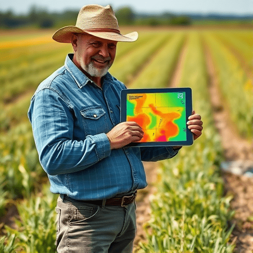
An Urban Climate Twin is a high-resolution, digital replica of a city’s environment that simulates microclimate conditions (e.g., surface temperature, air temperature, humidity, wind) and overlays human mobility and socio-demographic data to model real-world exposure to heat. The result is a spatio-temporal model that answers not just “where is it hottest?” but “who is exposed, when, and why?”
How it differs from traditional tools
- Hyperlocal fidelity: down to building facades, street canopies, and pocket parks rather than city blocks.
- Dynamic social coupling: integrates transit flows, foot traffic, workplace shifts, and event schedules.
- Action-oriented outputs: suggests targeted interventions (shade, water stations, cooling centers) prioritized by exposure and vulnerability.
How mobility and social data inform microclimate forecasts
Mobility and social datasets convert a purely environmental model into one that maps human exposure. Typical data inputs include anonymized mobile location traces, public transit ridership, pedestrian counts, workplace and school schedules, census-derived vulnerability indicators, and community-reported heat complaints.
Key insights from combined data
- Temporal exposure windows: identifying times of day when vulnerable populations are outdoors or in poorly ventilated transit hubs.
- Exposure pathways: mapping routes that consistently route people through heat corridors (e.g., bus-to-workwalks without shade).
- Intersecting vulnerabilities: where high heat, limited green space, and socioeconomic disadvantage overlap.
Building an effective Urban Climate Twin
Data architecture and sources
A robust twin relies on layered data:
- Environmental: LiDAR, satellite thermal imagery, local weather stations, and street-level sensors for microclimate calibration.
- Built environment: high-resolution land cover, building footprints, materials, and anthropogenic heat sources.
- Human dynamics: anonymized mobility flows, transit schedules, cell-tower handoffs, pedestrian counters, and demographic datasets.
- Community inputs: heat incident reports, survey data, and participatory mapping to capture lived experience.
Modeling and analytics techniques
Urban Climate Twins combine established physics-based microclimate models (e.g., urban canopy models, radiation balance calculations) with data-driven approaches (e.g., machine learning, agent-based models) to synthesize forecasts. Ensemble methods help quantify uncertainty; scenario modeling enables planners to test interventions like adding trees, reflective pavements, or temporary misting stations.
Forecasting heat-stress hotspots and prioritizing interventions
Forecasting with an Urban Climate Twin is both spatial and social. Rather than producing a single “hot spot” layer, it yields multiple outputs tailored to decision-making:
- Exposure maps by time-of-day and population cohort (e.g., outdoor workers, students, elderly at home).
- Risk heatmaps combining temperature, humidity, and activity intensity to estimate probable heat-stress incidents.
- Intervention impact simulations to compare outcomes (reduced exposure, avoided emergency calls) for each cooling strategy.
Prioritization framework
Interventions should be prioritized where models show the highest expected benefit per cost. A pragmatic framework evaluates: expected reduction in person-hours of exposure, population vulnerability, feasibility, maintenance burden, and equity impact. This ensures limited resources are directed to interventions that both lower risk and advance social justice.
Practical applications and a hypothetical scenario
Imagine a midsize city with a summer concert series in a riverfront park. The Urban Climate Twin analyzes forecasted weather, pedestrian flows from transit nodes, and local demographics to identify a nearby corridor where midday sun, high foot traffic, and low tree canopy converge. It recommends deploying temporary shade canopies at two bus stops, opening a temporary cooling tent near the plaza entrance, and adjusting transit wait times to stagger arrivals—actions that are simulated to reduce expected heat-related emergency calls by an estimated 45%.
Ethical considerations, privacy, and community engagement
Coupling human mobility with environmental data raises privacy and equity questions. Best practices include using aggregated and anonymized mobility traces, differential privacy techniques, explicit community consent when collecting neighborhood-level data, and transparent reporting on model limits. Co-design with community organizations ensures interventions are culturally appropriate and address local priorities.
Roadmap for city implementation
Cities can adopt Urban Climate Twins incrementally:
- Start small: pilot in a single neighborhood with existing sensor networks and transit data access.
- Validate models: cross-check forecasts against local temperature sensors and historical emergency-call records.
- Co-design interventions: engage residents and service providers to develop feasible actions.
- Scale iteratively: expand datasets and model fidelity as capacity grows, and integrate into emergency response and planning workflows.
Benefits for planners, public health, and communities
- Targeted action: investments go where they will protect the most people.
- Evidence-based planning: quantified impacts of cooling strategies before implementation.
- Equity-centered outcomes: explicit mapping of vulnerability ensures marginalized neighborhoods are prioritized.
Urban Climate Twins are more than predictive models; they are decision platforms that link urban physics with human behavior to protect lives during increasingly frequent heat events. When cities pair scientific rigor with ethical data practices and community engagement, these twins become powerful tools for resilient, equitable cooling strategies.
Conclusion: Urban Climate Twins that combine hyperlocal microclimate simulations with mobility and social data offer a practical, equitable path for forecasting heat-stress hotspots and prioritizing targeted cooling interventions that save lives and improve wellbeing across neighborhoods.
Ready to explore an Urban Climate Twin for your city? Contact local climate services or start a neighborhood pilot to map exposure and test targeted cooling strategies.